
GPS Machine Control for Excavators in Kenya: Grade Control Systems & Precision Earthmoving [2026]
3D machine guidance for excavators: how GPS grade control reduces basement excavation costs, eliminates rework, and transforms heavy equipment for hire productivity in Nairobi and across Kenya
Table of Contents
- 1. What is GPS Machine Control and Why It Matters for Excavation in Kenya
- 2. How GPS Grade Control Systems Work on Excavators
- 3. Types of Machine Guidance Systems for Kenyan Construction Sites
- 4. Precision Earthmoving Applications: Basement Excavation, Roads and Bulk Earthworks
- 5. Productivity and Cost Savings: The Business Case for GPS-Guided Heavy Equipment
- 6. GPS Machine Control Equipment and Hire Options in Kenya
- 7. Implementation: Getting Started with Grade Control on Your Project
- 8. Frequently Asked Questions
- 9. Conclusion
On a congested basement excavation site in Upper Hill Nairobi, where a 25-storey tower requires a 12-metre deep raft foundation within millimetres of design elevation, the traditional method would have three surveyors with dumpy levels and grade stakes working in constant communication with the excavator operator, stopping every two passes to check levels. The GPS machine-controlled excavator eliminates this ballet of inefficiency. The operator sees the design surface, the bucket position, and the cut/fill depth in real time on a cab-mounted display, achieving ±15mm accuracy without a single stake in the ground. This is precision earthmoving - and it is transforming excavation in Kenya. For developers managing basement excavation costs in Nairobi's competitive market, and for contractors hiring heavy equipment for hire who need to deliver faster with fewer operators, GPS grade control is no longer a luxury; it is a competitive necessity. Trust Partners Geo-Group Ltd now offers GPS-equipped excavators as part of our heavy equipment for hire fleet, bringing machine guidance technology to Kenyan commercial, infrastructure and basement excavation projects for the first time at scale. This guide explains how GPS machine control works, what it costs, and why it matters for your next excavation in Kenya.
Trust Partners Geo-Group Ltd - Equipment Technology & Geomatics Team
NCA-registered excavation contractor with 15+ years of earthworks experience and certified machine guidance system operators. Reviewed by civil engineers with geomatics specialisation.
1. What is GPS Machine Control and Why It Matters for Excavation in Kenya
GPS machine control - also called machine guidance, grade control or 3D excavation control - is a technology suite that tells an excavator operator exactly where the bucket tip is in three-dimensional space, relative to a digital design model. Instead of relying on stakes, string lines or grade checkers, the operator sees a colour-coded map of the design surface on a screen in the cab, with real-time cut/fill indicators that update 10 times per second as the machine moves.
For excavation in Kenya, this technology addresses three critical industry constraints:
- Skilled labour shortage: Kenya's construction boom has outpaced the supply of experienced machine operators and surveyors. GPS guidance allows a competent operator to achieve survey-grade accuracy without years of grade-reading experience;
- Tight urban sites: In Nairobi's Upper Hill, Kilimani and Westlands, basement excavation often occurs within metres of existing buildings, roads and utilities. Precision is not optional - over-excavation can undermine neighbouring foundations or require expensive structural fill;
- Cost pressure: With developers demanding faster programmes and tighter budgets, the 30-50% productivity gain from GPS-guided heavy equipment for hire directly improves project margins.
The technology has been standard on European and North American construction sites for over a decade. In Kenya, adoption is accelerating in 2026 as major infrastructure projects - the Nairobi-Mombasa Expressway, Nairobi-Nakuru highway upgrades, and numerous high-rise developments - demand accuracy and speed that traditional methods cannot deliver. Contractors who adopt GPS machine control now will dominate the premium basement excavation and infrastructure markets within three years.
2. How GPS Grade Control Systems Work on Excavators
Understanding the components of a GPS machine control system explains why it delivers accuracy and productivity that traditional methods cannot match.
GNSS Receivers and Correction Signals
The system starts with multi-constellation GNSS antennas mounted on the excavator's house (the rotating platform). These antennas track GPS, GLONASS, Galileo and BeiDou satellites simultaneously. Raw satellite positioning is accurate to ±3-5 metres - useless for construction. To achieve centimetre accuracy, the system uses RTK (Real-Time Kinematic) correction from a base station on site or from Kenya's CORS (Continuously Operating Reference Station) network via 4G internet. The correction signal eliminates atmospheric and orbital errors, delivering ±10-20mm accuracy in real time.
Inertial Measurement and Angle Sensors
Satellites tell the system where the machine is. Angle sensors on the boom, stick and bucket pin joints tell the system how the machine is configured. An inertial measurement unit (IMU) compensates for machine tilt and vibration. The software triangulates these inputs to calculate the exact three-dimensional position of the bucket tip - the cutting edge that matters - relative to the design surface.
The Cab Display and Design Model
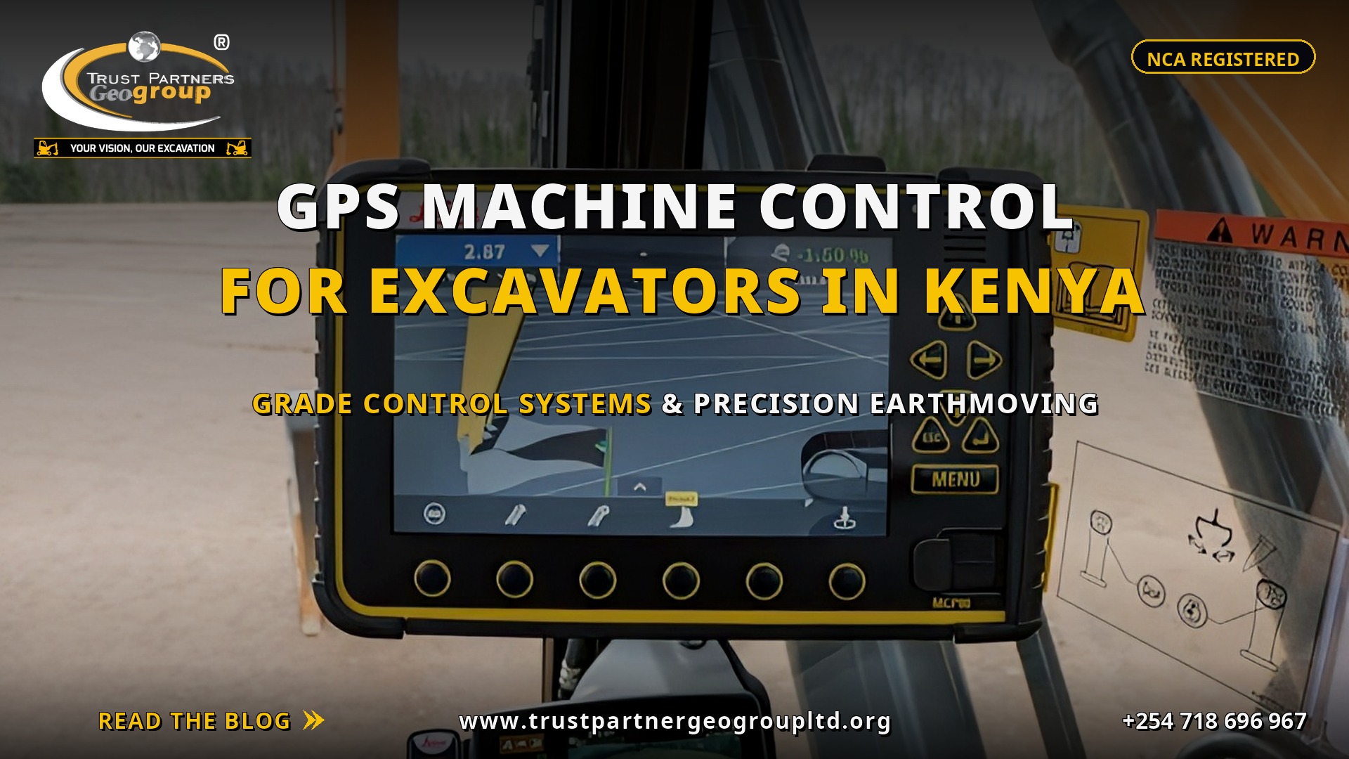
The operator sees a rugged touchscreen display in the cab showing: a plan view of the site with the machine's position; a cross-section view showing design surface (blue), existing ground (brown) and the bucket's current path; colour-coded cut/fill arrows (red = cut, green = fill, yellow = on grade); and numeric readouts of elevation difference, slope percentage and distance to target. The operator simply follows the visual cues, digging or filling until the indicators show green. No stakes. No radio calls to surveyors. No guesswork.
Accuracy Warning
GPS machine control accuracy depends on maintaining RTK correction lock. If the excavator moves behind a tall building, under dense tree cover, or into a deep cut where satellite signals are blocked, accuracy degrades. For deep basement excavation in Nairobi's urban canyons, contractors should verify signal coverage across the full excavation depth before committing to a GNSS-only solution. Hybrid systems with total station backup eliminate this risk.
3. Types of Machine Guidance Systems for Kenyan Construction Sites
Not all machine guidance is GPS-based. Four system types serve different accuracy requirements and budgets for excavation in Kenya.
| System Type | Accuracy | Best Application | Hire Premium (Kenya 2026) |
|---|---|---|---|
| 2D Laser | ±20-30mm | Flat slabs, pavements, simple grading | +KES 1,000-1,500/hr |
| 3D GNSS (RTK) | ±10-20mm | Bulk earthworks, basement excavation, roads | +KES 2,000-3,500/hr |
| Total Station Robotic | ±5-10mm | Structural foundations, precision finishing | +KES 3,000-5,000/hr |
| Hybrid GNSS + TS | ±5-15mm | Complex urban sites, deep cuts | +KES 3,500-5,500/hr |
2D Laser Systems
2D systems use a rotating laser level and receiver on the machine to maintain a single elevation or slope. They are simple, reliable and affordable but limited to flat or single-slope work. Best for warehouse floor subgrades, parking lots and simple grading where 3D complexity is not required.
3D GNSS Systems
3D GNSS is the workhorse of modern earthworks. It handles complex design surfaces with curves, varying slopes and multiple elevation zones. For basement excavation with stepped foundations, ramped access and drainage falls, 3D GNSS is essential. Trust Partners Geo-Group Ltd deploys 3D GNSS on all GPS-guided heavy equipment for hire assignments.
Total Station Robotic Systems
Robotic total stations track a prism mounted on the excavator and provide millimetre accuracy without relying on satellites. They are immune to urban canyon signal loss but require line-of-sight to the instrument. Ideal for high-precision structural excavation, final trim passes and environments where GNSS is unreliable.
Hybrid Systems
Hybrid systems use GNSS for open-area productivity and automatically switch to total station tracking when GNSS accuracy degrades. They offer the best of both worlds and are increasingly specified for complex basement excavation in dense Nairobi neighbourhoods where satellite visibility changes as neighbouring towers rise.
4. Precision Earthmoving Applications: Basement Excavation, Roads and Bulk Earthworks
GPS machine control delivers value across the full spectrum of excavation in Kenya, but three applications show the strongest return on investment.
Basement Excavation
Basement excavation demands the tightest tolerances in earthworks. A raft foundation for a high-rise requires subgrade level within ±20mm across hundreds of square metres. Over-excavation by 100mm means importing and compacting hundreds of cubic metres of structural fill at KES 3,000-5,000 per m3. Under-excavation means hand-trimming or re-digging with a mini-excavator, destroying productivity. GPS-guided excavators hit design grade in a single pass, eliminating both problems. On a recent 3,000 m3 basement excavation in Kilimani, GPS guidance eliminated 120 m3 of over-excavation, saving KES 480,000 in fill material and 4 days of programme.
Road Construction and Subgrade Preparation
Road earthworks require precise subgrade levels, cambers and cross-falls to ensure pavement performance. GPS-guided motor graders and excavators cut subgrade to design elevation while maintaining the correct longitudinal gradient and superelevation on curves. For the Nairobi-Mombasa Expressway and county road projects, precision earthmoving reduces asphalt thickness variation, preventing premature pavement failure and costly maintenance. Trust Partners Geo-Group Ltd provides GPS-equipped graders and excavators for road subgrade contracts nationwide.
Bulk Earthworks and Cut-to-Fill Balance
On large-scale bulk excavation projects - residential estates, industrial parks and dam construction - GPS machine control enables real-time volume tracking. The system calculates cut and fill volumes as the work proceeds, allowing the contractor to optimise haul routes and balance earthworks without waiting for end-of-month surveys. This cut-to-fill precision reduces haul distances, fuel consumption and the need for borrow pits or spoil disposal.
Case Study: GPS-Guided Basement Excavation in Westlands
A 16-storey commercial tower in Westlands required a 14-metre deep basement with a 2-metre thick raft slab, meaning subgrade tolerance of ±15mm across 2,400 m2. Using traditional methods, the contractor estimated 18 days with three surveyors on rotation. Trust Partners Geo-Group Ltd deployed a 30-tonne GPS-guided excavator with 3D RTK guidance. The subgrade was completed in 11 days with zero over-excavation, one surveyor performing spot checks only, and a final as-built survey showing 98% of the surface within ±12mm of design. The developer saved KES 1.2 million in programme and fill costs.
5. Productivity and Cost Savings: The Business Case for GPS-Guided Heavy Equipment
The business case for GPS machine control on heavy equipment for hire rests on four pillars: labour reduction, speed increase, rework elimination and fuel savings.
| Metric | Traditional Methods | GPS Machine Control | Improvement |
|---|---|---|---|
| Production rate (m3/hr) | 80-120 | 150-220 | +40-60% |
| Grade accuracy | ±50-100mm | ±10-20mm | 5x better |
| Rework / over-excavation | 8-15% | 1-3% | -80% |
| Fuel per m3 moved | 3.5-4.5 L | 2.0-2.8 L | -35% |
| Survey staff required | 2-3 grade checkers | 0-1 spot checker | -70% |
| Stake reset frequency | Every 1-2 days | Never | Eliminated |
Labour Cost Reduction
A traditional basement excavation crew includes 2-3 surveyors or grade checkers at KES 3,000-5,000 per day each. Over a 20-day excavation, this is KES 120,000-300,000 in labour that GPS guidance eliminates. The operator becomes the grade controller, reading the design surface directly from the screen.
Speed and Programme Compression
GPS-guided excavators do not stop for grade checks. They do not wait for stakes to be reset after rain or after a truck runs over them. They do not re-dig over-excavated areas. The result is 40-60% more production per hour. On programme-critical basement excavation projects where every day of delay costs KES 50,000-200,000 in finance and overhead, this speed is transformational.
Rework and Material Savings
Over-excavation is silent profit destruction. A 100mm over-dig on a 2,000 m2 basement slab area equals 200 m3 of unnecessary structural fill at KES 3,000-5,000 per m3 - KES 600,000-1,000,000 wasted. GPS guidance maintains the design surface to within ±15mm, making over-excavation a rarity rather than a norm.
Fuel and Emissions
By eliminating unnecessary passes, idle waiting and rework travel, GPS-guided machines reduce fuel consumption by 25-35%. For a 30-tonne excavator consuming 15-20 litres per hour, this saves KES 2,000-3,500 per day in diesel costs while reducing carbon emissions - a growing consideration for NEMA compliance and green building certification.
6. GPS Machine Control Equipment and Hire Options in Kenya
Until 2025, GPS machine control was virtually unavailable on heavy equipment for hire in Kenya. Contractors who wanted precision earthmoving had to purchase systems outright - a KES 3.5-8 million investment - or import specialists from South Africa or Europe. Trust Partners Geo-Group Ltd has changed this by integrating 3D grade control across our fleet.
Available GPS-Guided Equipment
Our current GPS-equipped fleet includes: 20-tonne excavators with 3D GNSS RTK for mid-size basement excavation and road earthworks; 30-tonne excavators with hybrid GNSS/total station for deep urban basement excavation and precision trimming; 35-tonne excavators with 3D GNSS for bulk earthworks and mining applications; and motor graders with 3D blade control for road subgrade and finish grading. All machines include RTK base stations, 4G modems for CORS connectivity, and certified operators trained in machine guidance software.
Hire Rates and Pricing Structure
GPS machine control is offered as an optional technology package on long-term heavy equipment for hire contracts. The pricing structure is: standard excavator hire rate (KES 8,000-14,000/hr depending on size); GPS technology premium (+KES 2,000-4,000/hr); project setup and calibration (KES 50,000-100,000 one-time, covering 3D model loading, base station installation and operator orientation); and daily accuracy verification (included in hire package). For contracts exceeding 300 hours, the setup fee is waived. This makes GPS guidance accessible to mid-size developers who could not justify capital purchase.
Software and Design File Compatibility
Trust Partners Geo-Group Ltd systems accept design files in .dwg, .dxf, .xml, .ln3 and .tn3 formats from AutoCAD, Civil 3D, Bentley and Trimble Business Center. Our geomatics team converts engineer designs into machine-ready models, ensuring that the operator sees exactly what the designer intended. We also provide cloud-based production reporting, allowing project managers to track volumes, machine locations and idle time from their office.
7. Implementation: Getting Started with Grade Control on Your Project
Adopting GPS machine control for excavation in Kenya requires more than hiring an equipped machine. Successful implementation follows a seven-stage process that ensures accuracy from day one.
Stage 1: Pre-Construction Survey and 3D Model Preparation
A high-accuracy topographic survey creates the existing ground model. The engineer's design surface is then merged into the machine control software. Coordinate system alignment is critical - Kenyan projects typically use Arc 1960 or UTM Zone 37S. Any mismatch between the design grid and the machine's GNSS coordinate system will produce systematic errors across the entire site.
Stage 2: Base Station and Correction Network
The RTK base station must be positioned with a stable power supply and clear sky view. In Nairobi's urban environment, we often mount base stations on existing structures or use tripod setups on building rooftops. For remote sites without reliable 4G, UHF radio transmission provides correction coverage up to 5 kilometres.
Stage 3: Machine Calibration and Test Cuts
Every machine is calibrated to measure boom, stick and bucket geometry precisely. A test cut on a non-critical area is then surveyed independently to verify that the machine's "as-dug" surface matches the design within tolerance. We do not begin production until test cut verification is signed off.
Stage 4: Operator Training and Production
Even experienced operators need 4-8 hours to adapt to GPS guidance. Training covers display navigation, alarm settings, slope control and emergency procedures if correction signal is lost. Trust Partners Geo-Group Ltd includes mandatory training in every GPS hire package.
Stage 5: Ongoing Accuracy Checks and Documentation
Independent surveyors check production surfaces daily or weekly depending on tolerance requirements. Machine data logs provide automatic volume tracking for quantity surveying. For basement excavation and NEMA-regulated projects, this documentation supports compliance and audit trails.
8. Frequently Asked Questions: GPS Machine Control & Precision Earthmoving in Kenya
What is GPS machine control for excavators and how does it work?
GPS machine control for excavators is a 3D machine guidance system that uses GNSS receivers, inertial measurement units (IMUs) and angle sensors mounted on the excavator boom, stick and bucket to calculate the bucket's exact position in real time. This data is compared against a digital terrain model (DTM) or 3D design surface loaded into the cab display. The operator sees cut/fill indicators, design elevations and slope information on a screen, allowing them to excavate to precise grades without stakes, grade checkers or constant surveying. For excavation in Kenya, where skilled operator shortages and tight urban sites in Nairobi create productivity bottlenecks, GPS machine control delivers ±10-20mm accuracy while increasing production by 40-60%.
How accurate is GPS grade control on Kenyan construction sites?
Accuracy depends on the system type and correction method. Standard GNSS with RTK (Real-Time Kinematic) base stations delivers ±10-20mm horizontal and ±15-30mm vertical accuracy - sufficient for bulk earthworks, basement excavation and road subgrades. Total station robotic guidance achieves ±5-10mm, suitable for structural foundations and precision finishing. Hybrid systems combining GNSS and total station provide ±5-15mm across the site. In Nairobi's urban canyons with tall buildings, multi-constellation GNSS receivers (GPS, GLONASS, Galileo, BeiDou) with tilt compensation maintain accuracy where single-frequency systems lose signal. For basement excavation in Kenya where over-dig can cost KES 5,000-8,000 per m3 in structural fill, this accuracy eliminates rework and material waste.
What types of excavators can use GPS machine guidance systems?
GPS machine guidance can be installed on any hydraulic excavator from 8 tonnes to 50 tonnes, though it is most cost-effective on machines from 20 tonnes upward where production volume justifies the technology premium. Trust Partners Geo-Group Ltd offers GPS-equipped 20-tonne, 30-tonne and 35-tonne excavators as part of our heavy equipment for hire fleet. The system requires mounting brackets on the boom, stick and bucket, a cab display, and a GNSS antenna on the machine house. Retrofit installation takes 1-2 days. Mini-excavators (5-8 tonne) can use compact guidance systems for utility trenching and confined basement excavation where precision matters more than production volume.
Does GPS machine control reduce basement excavation costs in Kenya?
Yes. GPS machine control reduces basement excavation costs in Kenya through four mechanisms: elimination of grade checker labour (2-3 surveyors at KES 3,000-5,000 per day each); prevention of over-excavation that requires expensive structural backfill (saving KES 200,000-500,000 on a typical 2,000 m3 basement); 30-40% faster cycle times that reduce equipment hire hours; and elimination of rework and re-surveying. On a recent 15-metre deep basement excavation in Kilimani, GPS guidance reduced the programme by 8 days and cut earthworks costs by 18% compared to traditional stake-and-check methods. The technology premium is recovered within the first 100-150 machine hours on most basement excavation projects.
Can GPS-guided excavators work in urban Nairobi with tall buildings and signal interference?
Yes, modern GPS machine control systems use multi-constellation GNSS receivers that track GPS, GLONASS, Galileo and BeiDou satellites simultaneously, maintaining lock even in urban canyons where older single-system receivers failed. Tilt-compensated antennas maintain accuracy when the machine is on slopes. For deep basement excavation in Upper Hill or Parklands where buildings exceed 20 storeys, contractors can deploy a local RTK base station on site with UHF radio or 4G correction transmission, or use Kenya's CORS network (Continuously Operating Reference Stations) via NTRIP internet correction. In the most challenging environments, total station robotic guidance provides a reliable backup that does not rely on satellite signals at all.
How much does GPS machine control cost in Kenya for heavy equipment hire?
In Kenya's heavy equipment for hire market, GPS-equipped excavators command a premium of KES 2,000-4,000 per hour above standard hire rates for 20-30 tonne machines. For project-based pricing, expect a setup and calibration fee of KES 50,000-100,000 per project (covering 3D model loading, base station installation and operator training) plus the hourly premium. On a 500-hour basement excavation project, the total GPS premium is KES 1.0-1.5 million - typically 6-10% of earthworks costs - but this is offset by 15-25% savings in total project costs through faster production, reduced labour and eliminated rework. Trust Partners Geo-Group Ltd offers GPS machine control as an optional add-on to all long-term heavy equipment for hire contracts.
Is GPS machine control better than traditional surveying for earthworks in Kenya?
For production earthworks, GPS machine control is superior to traditional surveying in speed, consistency and cost. Traditional methods require surveyors to set stakes or spray marks every 5-10 metres, which are then destroyed by equipment, weather or site activity and must be reset repeatedly. On a 1-hectare basement excavation site, stakes may be reset 20-30 times. GPS guidance eliminates stakes entirely - the design surface lives in the machine's computer. However, traditional surveying remains essential for initial control network establishment, boundary verification and final as-built certification. The best practice in Kenyan excavation is GPS for production and traditional survey for verification - not replacement, but augmentation.
Where can I hire GPS-equipped excavators with machine guidance in Kenya?
Trust Partners Geo-Group Ltd is among the first contractors in Kenya to offer GPS machine control as part of our heavy equipment for hire fleet. We provide 20-tonne, 30-tonne and 35-tonne excavators equipped with 3D GNSS grade control systems, RTK base stations, and trained operators who understand precision earthmoving for basement excavation, road construction and bulk earthworks. Our service includes 3D model preparation, site calibration, operator training and real-time technical support. We serve Nairobi, Mombasa, Kisumu, Nakuru, Eldoret and nationwide. Contact us at +254 718 68 69 67 or info@trustpartnergeogroupltd.org to discuss GPS-guided excavation for your next project.
9. Conclusion: The Future of Excavation in Kenya is Guided
GPS machine control is not a futuristic novelty - it is the present reality of competitive excavation in Kenya. The contractor who digs by stakes and guesswork will be undercut on price, outpaced on programme and outclassed on quality by the contractor who digs by data. For developers, the message is equally clear: specifying GPS-guided heavy equipment for hire on your basement excavation or infrastructure project is not a cost increase; it is a cost reduction disguised as technology. The savings in fill material, survey labour, programme duration and rework dwarf the modest hire premium.
In 2026, Kenya's construction industry stands at an inflection point. The projects getting built - 30-storey towers with 15-metre basements, expressways with millimetre-grade subgrades, industrial parks with cut-to-fill precision - demand accuracy that human senses alone cannot deliver. Machine guidance bridges this gap, turning good operators into precision earthmoving specialists and great operators into production machines.
Trust Partners Geo-Group Ltd is committed to leading this transformation. Our GPS-equipped fleet, certified operators, geomatics support team and project documentation services give Kenyan developers and contractors access to precision earthmoving that was previously available only on international megaprojects. Whether you are planning a basement excavation in Nairobi, a road subgrade in Nakuru, or a bulk earthworks project in Mombasa, our heavy equipment for hire with GPS machine control delivers the accuracy, speed and documentation you need to win.
GPS Machine Control & Precision Earthmoving
Hire GPS-guided excavators for basement excavation, road earthworks and bulk projects in Nairobi, Mombasa, Kisumu and across Kenya.
Free lead magnet: ask for our GPS Machine Control Project Setup Checklist (PDF) - 3D model requirements, base station specs, accuracy verification protocol and operator training outline for your next precision earthmoving project.
Related Resources
Basement Excavation Depth Guide: From 4 Meters to 30 Meters in Kenya
Technical depth guide for basement excavation planning, dewatering and shoring across all project scales in Kenya.
READ MOREExcavator Hire Prices in Kenya: Hourly, Daily & Monthly Rates [2026]
Transparent 2026 pricing for excavator hire across all machine sizes, including GPS-equipped options and long-term contract discounts.
READ MORE11-20 Ton vs 30 Ton vs 50 Ton Excavator: Which Size Do You Need?
Equipment selection guide matching excavator tonnage to project type, from tight urban basement excavation to bulk earthworks and mining.
READ MOREEarthworks QA/QC: Compaction Testing, Density Control & Kenyan Standards Compliance
Quality control protocols that complement GPS precision earthmoving - ensuring that accurate grades are backed by certified compaction and density.
READ MOREMega Basement Excavation: Managing Projects Over 30 Meters Deep in East Africa
Deep basement excavation expertise for Kenya's tallest developments - dewatering, shoring, mucking and precision grading at extreme depth.
READ MOREExcavation in Kenya: Complete Guide to Costs, Methods & Contractors [2026]
The definitive overview of excavation in Kenya - methods, regulations, costs and contractor selection for every project type.
READ MORETRUST PARTNERS GEO-GROUP LTD | YOUR VISION, OUR EXCAVATION
WEBSITE: WWW.TRUSTPARTNERGEOGROUPLTD.ORG | EMAIL: INFO@TRUSTPARTNERGEOGROUPLTD.ORG | PHONE: +254 718 68 69 67
FOLLOW US: FACEBOOK | TIKTOK | INSTAGRAM | LINKEDIN
© 2026 TRUST PARTNERS GEO-GROUP LTD. ALL RIGHTS RESERVED.
GPS Machine Control for Excavators in Kenya: Grade Control Systems & Precision Earthmoving [2026]
3D machine guidance for excavators: how GPS grade control reduces basement excavation costs, eliminates rework, and transforms heavy equipment for hire productivity in Nairobi and across Kenya
Table of Contents
- 1. What is GPS Machine Control and Why It Matters for Excavation in Kenya
- 2. How GPS Grade Control Systems Work on Excavators
- 3. Types of Machine Guidance Systems for Kenyan Construction Sites
- 4. Precision Earthmoving Applications: Basement Excavation, Roads and Bulk Earthworks
- 5. Productivity and Cost Savings: The Business Case for GPS-Guided Heavy Equipment
- 6. GPS Machine Control Equipment and Hire Options in Kenya
- 7. Implementation: Getting Started with Grade Control on Your Project
- 8. Frequently Asked Questions
- 9. Conclusion
On a congested basement excavation site in Upper Hill Nairobi, where a 25-storey tower requires a 12-metre deep raft foundation within millimetres of design elevation, the traditional method would have three surveyors with dumpy levels and grade stakes working in constant communication with the excavator operator, stopping every two passes to check levels. The GPS machine-controlled excavator eliminates this ballet of inefficiency. The operator sees the design surface, the bucket position, and the cut/fill depth in real time on a cab-mounted display, achieving ±15mm accuracy without a single stake in the ground. This is precision earthmoving - and it is transforming excavation in Kenya. For developers managing basement excavation costs in Nairobi's competitive market, and for contractors hiring heavy equipment for hire who need to deliver faster with fewer operators, GPS grade control is no longer a luxury; it is a competitive necessity. Trust Partners Geo-Group Ltd now offers GPS-equipped excavators as part of our heavy equipment for hire fleet, bringing machine guidance technology to Kenyan commercial, infrastructure and basement excavation projects for the first time at scale. This guide explains how GPS machine control works, what it costs, and why it matters for your next excavation in Kenya.
Trust Partners Geo-Group Ltd - Equipment Technology & Geomatics Team
NCA-registered excavation contractor with 15+ years of earthworks experience and certified machine guidance system operators. Reviewed by civil engineers with geomatics specialisation.
1. What is GPS Machine Control and Why It Matters for Excavation in Kenya
GPS machine control - also called machine guidance, grade control or 3D excavation control - is a technology suite that tells an excavator operator exactly where the bucket tip is in three-dimensional space, relative to a digital design model. Instead of relying on stakes, string lines or grade checkers, the operator sees a colour-coded map of the design surface on a screen in the cab, with real-time cut/fill indicators that update 10 times per second as the machine moves.
For excavation in Kenya, this technology addresses three critical industry constraints:
- Skilled labour shortage: Kenya's construction boom has outpaced the supply of experienced machine operators and surveyors. GPS guidance allows a competent operator to achieve survey-grade accuracy without years of grade-reading experience;
- Tight urban sites: In Nairobi's Upper Hill, Kilimani and Westlands, basement excavation often occurs within metres of existing buildings, roads and utilities. Precision is not optional - over-excavation can undermine neighbouring foundations or require expensive structural fill;
- Cost pressure: With developers demanding faster programmes and tighter budgets, the 30-50% productivity gain from GPS-guided heavy equipment for hire directly improves project margins.
The technology has been standard on European and North American construction sites for over a decade. In Kenya, adoption is accelerating in 2026 as major infrastructure projects - the Nairobi-Mombasa Expressway, Nairobi-Nakuru highway upgrades, and numerous high-rise developments - demand accuracy and speed that traditional methods cannot deliver. Contractors who adopt GPS machine control now will dominate the premium basement excavation and infrastructure markets within three years.
2. How GPS Grade Control Systems Work on Excavators
Understanding the components of a GPS machine control system explains why it delivers accuracy and productivity that traditional methods cannot match.
GNSS Receivers and Correction Signals
The system starts with multi-constellation GNSS antennas mounted on the excavator's house (the rotating platform). These antennas track GPS, GLONASS, Galileo and BeiDou satellites simultaneously. Raw satellite positioning is accurate to ±3-5 metres - useless for construction. To achieve centimetre accuracy, the system uses RTK (Real-Time Kinematic) correction from a base station on site or from Kenya's CORS (Continuously Operating Reference Station) network via 4G internet. The correction signal eliminates atmospheric and orbital errors, delivering ±10-20mm accuracy in real time.
Inertial Measurement and Angle Sensors
Satellites tell the system where the machine is. Angle sensors on the boom, stick and bucket pin joints tell the system how the machine is configured. An inertial measurement unit (IMU) compensates for machine tilt and vibration. The software triangulates these inputs to calculate the exact three-dimensional position of the bucket tip - the cutting edge that matters - relative to the design surface.
The Cab Display and Design Model
The operator sees a rugged touchscreen display in the cab showing: a plan view of the site with the machine's position; a cross-section view showing design surface (blue), existing ground (brown) and the bucket's current path; colour-coded cut/fill arrows (red = cut, green = fill, yellow = on grade); and numeric readouts of elevation difference, slope percentage and distance to target. The operator simply follows the visual cues, digging or filling until the indicators show green. No stakes. No radio calls to surveyors. No guesswork.
Accuracy Warning
GPS machine control accuracy depends on maintaining RTK correction lock. If the excavator moves behind a tall building, under dense tree cover, or into a deep cut where satellite signals are blocked, accuracy degrades. For deep basement excavation in Nairobi's urban canyons, contractors should verify signal coverage across the full excavation depth before committing to a GNSS-only solution. Hybrid systems with total station backup eliminate this risk.
3. Types of Machine Guidance Systems for Kenyan Construction Sites
Not all machine guidance is GPS-based. Four system types serve different accuracy requirements and budgets for excavation in Kenya.
| System Type | Accuracy | Best Application | Hire Premium (Kenya 2026) |
|---|---|---|---|
| 2D Laser | ±20-30mm | Flat slabs, pavements, simple grading | +KES 1,000-1,500/hr |
| 3D GNSS (RTK) | ±10-20mm | Bulk earthworks, basement excavation, roads | +KES 2,000-3,500/hr |
| Total Station Robotic | ±5-10mm | Structural foundations, precision finishing | +KES 3,000-5,000/hr |
| Hybrid GNSS + TS | ±5-15mm | Complex urban sites, deep cuts | +KES 3,500-5,500/hr |
2D Laser Systems
2D systems use a rotating laser level and receiver on the machine to maintain a single elevation or slope. They are simple, reliable and affordable but limited to flat or single-slope work. Best for warehouse floor subgrades, parking lots and simple grading where 3D complexity is not required.
3D GNSS Systems
3D GNSS is the workhorse of modern earthworks. It handles complex design surfaces with curves, varying slopes and multiple elevation zones. For basement excavation with stepped foundations, ramped access and drainage falls, 3D GNSS is essential. Trust Partners Geo-Group Ltd deploys 3D GNSS on all GPS-guided heavy equipment for hire assignments.
Total Station Robotic Systems
Robotic total stations track a prism mounted on the excavator and provide millimetre accuracy without relying on satellites. They are immune to urban canyon signal loss but require line-of-sight to the instrument. Ideal for high-precision structural excavation, final trim passes and environments where GNSS is unreliable.
Hybrid Systems
Hybrid systems use GNSS for open-area productivity and automatically switch to total station tracking when GNSS accuracy degrades. They offer the best of both worlds and are increasingly specified for complex basement excavation in dense Nairobi neighbourhoods where satellite visibility changes as neighbouring towers rise.
4. Precision Earthmoving Applications: Basement Excavation, Roads and Bulk Earthworks
GPS machine control delivers value across the full spectrum of excavation in Kenya, but three applications show the strongest return on investment.
Basement Excavation
Basement excavation demands the tightest tolerances in earthworks. A raft foundation for a high-rise requires subgrade level within ±20mm across hundreds of square metres. Over-excavation by 100mm means importing and compacting hundreds of cubic metres of structural fill at KES 3,000-5,000 per m3. Under-excavation means hand-trimming or re-digging with a mini-excavator, destroying productivity. GPS-guided excavators hit design grade in a single pass, eliminating both problems. On a recent 3,000 m3 basement excavation in Kilimani, GPS guidance eliminated 120 m3 of over-excavation, saving KES 480,000 in fill material and 4 days of programme.
Road Construction and Subgrade Preparation
Road earthworks require precise subgrade levels, cambers and cross-falls to ensure pavement performance. GPS-guided motor graders and excavators cut subgrade to design elevation while maintaining the correct longitudinal gradient and superelevation on curves. For the Nairobi-Mombasa Expressway and county road projects, precision earthmoving reduces asphalt thickness variation, preventing premature pavement failure and costly maintenance. Trust Partners Geo-Group Ltd provides GPS-equipped graders and excavators for road subgrade contracts nationwide.
Bulk Earthworks and Cut-to-Fill Balance
On large-scale bulk excavation projects - residential estates, industrial parks and dam construction - GPS machine control enables real-time volume tracking. The system calculates cut and fill volumes as the work proceeds, allowing the contractor to optimise haul routes and balance earthworks without waiting for end-of-month surveys. This cut-to-fill precision reduces haul distances, fuel consumption and the need for borrow pits or spoil disposal.
Case Study: GPS-Guided Basement Excavation in Westlands
A 16-storey commercial tower in Westlands required a 14-metre deep basement with a 2-metre thick raft slab, meaning subgrade tolerance of ±15mm across 2,400 m2. Using traditional methods, the contractor estimated 18 days with three surveyors on rotation. Trust Partners Geo-Group Ltd deployed a 30-tonne GPS-guided excavator with 3D RTK guidance. The subgrade was completed in 11 days with zero over-excavation, one surveyor performing spot checks only, and a final as-built survey showing 98% of the surface within ±12mm of design. The developer saved KES 1.2 million in programme and fill costs.
5. Productivity and Cost Savings: The Business Case for GPS-Guided Heavy Equipment
The business case for GPS machine control on heavy equipment for hire rests on four pillars: labour reduction, speed increase, rework elimination and fuel savings.
| Metric | Traditional Methods | GPS Machine Control | Improvement |
|---|---|---|---|
| Production rate (m3/hr) | 80-120 | 150-220 | +40-60% |
| Grade accuracy | ±50-100mm | ±10-20mm | 5x better |
| Rework / over-excavation | 8-15% | 1-3% | -80% |
| Fuel per m3 moved | 3.5-4.5 L | 2.0-2.8 L | -35% |
| Survey staff required | 2-3 grade checkers | 0-1 spot checker | -70% |
| Stake reset frequency | Every 1-2 days | Never | Eliminated |
Labour Cost Reduction
A traditional basement excavation crew includes 2-3 surveyors or grade checkers at KES 3,000-5,000 per day each. Over a 20-day excavation, this is KES 120,000-300,000 in labour that GPS guidance eliminates. The operator becomes the grade controller, reading the design surface directly from the screen.
Speed and Programme Compression
GPS-guided excavators do not stop for grade checks. They do not wait for stakes to be reset after rain or after a truck runs over them. They do not re-dig over-excavated areas. The result is 40-60% more production per hour. On programme-critical basement excavation projects where every day of delay costs KES 50,000-200,000 in finance and overhead, this speed is transformational.
Rework and Material Savings
Over-excavation is silent profit destruction. A 100mm over-dig on a 2,000 m2 basement slab area equals 200 m3 of unnecessary structural fill at KES 3,000-5,000 per m3 - KES 600,000-1,000,000 wasted. GPS guidance maintains the design surface to within ±15mm, making over-excavation a rarity rather than a norm.
Fuel and Emissions
By eliminating unnecessary passes, idle waiting and rework travel, GPS-guided machines reduce fuel consumption by 25-35%. For a 30-tonne excavator consuming 15-20 litres per hour, this saves KES 2,000-3,500 per day in diesel costs while reducing carbon emissions - a growing consideration for NEMA compliance and green building certification.
6. GPS Machine Control Equipment and Hire Options in Kenya
Until 2025, GPS machine control was virtually unavailable on heavy equipment for hire in Kenya. Contractors who wanted precision earthmoving had to purchase systems outright - a KES 3.5-8 million investment - or import specialists from South Africa or Europe. Trust Partners Geo-Group Ltd has changed this by integrating 3D grade control across our fleet.
Available GPS-Guided Equipment
Our current GPS-equipped fleet includes: 20-tonne excavators with 3D GNSS RTK for mid-size basement excavation and road earthworks; 30-tonne excavators with hybrid GNSS/total station for deep urban basement excavation and precision trimming; 35-tonne excavators with 3D GNSS for bulk earthworks and mining applications; and motor graders with 3D blade control for road subgrade and finish grading. All machines include RTK base stations, 4G modems for CORS connectivity, and certified operators trained in machine guidance software.
Hire Rates and Pricing Structure
GPS machine control is offered as an optional technology package on long-term heavy equipment for hire contracts. The pricing structure is: standard excavator hire rate (KES 8,000-14,000/hr depending on size); GPS technology premium (+KES 2,000-4,000/hr); project setup and calibration (KES 50,000-100,000 one-time, covering 3D model loading, base station installation and operator orientation); and daily accuracy verification (included in hire package). For contracts exceeding 300 hours, the setup fee is waived. This makes GPS guidance accessible to mid-size developers who could not justify capital purchase.
Software and Design File Compatibility
Trust Partners Geo-Group Ltd systems accept design files in .dwg, .dxf, .xml, .ln3 and .tn3 formats from AutoCAD, Civil 3D, Bentley and Trimble Business Center. Our geomatics team converts engineer designs into machine-ready models, ensuring that the operator sees exactly what the designer intended. We also provide cloud-based production reporting, allowing project managers to track volumes, machine locations and idle time from their office.
7. Implementation: Getting Started with Grade Control on Your Project
Adopting GPS machine control for excavation in Kenya requires more than hiring an equipped machine. Successful implementation follows a seven-stage process that ensures accuracy from day one.
Stage 1: Pre-Construction Survey and 3D Model Preparation
A high-accuracy topographic survey creates the existing ground model. The engineer's design surface is then merged into the machine control software. Coordinate system alignment is critical - Kenyan projects typically use Arc 1960 or UTM Zone 37S. Any mismatch between the design grid and the machine's GNSS coordinate system will produce systematic errors across the entire site.
Stage 2: Base Station and Correction Network
The RTK base station must be positioned with a stable power supply and clear sky view. In Nairobi's urban environment, we often mount base stations on existing structures or use tripod setups on building rooftops. For remote sites without reliable 4G, UHF radio transmission provides correction coverage up to 5 kilometres.
Stage 3: Machine Calibration and Test Cuts
Every machine is calibrated to measure boom, stick and bucket geometry precisely. A test cut on a non-critical area is then surveyed independently to verify that the machine's "as-dug" surface matches the design within tolerance. We do not begin production until test cut verification is signed off.
Stage 4: Operator Training and Production
Even experienced operators need 4-8 hours to adapt to GPS guidance. Training covers display navigation, alarm settings, slope control and emergency procedures if correction signal is lost. Trust Partners Geo-Group Ltd includes mandatory training in every GPS hire package.
Stage 5: Ongoing Accuracy Checks and Documentation
Independent surveyors check production surfaces daily or weekly depending on tolerance requirements. Machine data logs provide automatic volume tracking for quantity surveying. For basement excavation and NEMA-regulated projects, this documentation supports compliance and audit trails.
8. Frequently Asked Questions: GPS Machine Control & Precision Earthmoving in Kenya
What is GPS machine control for excavators and how does it work?
GPS machine control for excavators is a 3D machine guidance system that uses GNSS receivers, inertial measurement units (IMUs) and angle sensors mounted on the excavator boom, stick and bucket to calculate the bucket's exact position in real time. This data is compared against a digital terrain model (DTM) or 3D design surface loaded into the cab display. The operator sees cut/fill indicators, design elevations and slope information on a screen, allowing them to excavate to precise grades without stakes, grade checkers or constant surveying. For excavation in Kenya, where skilled operator shortages and tight urban sites in Nairobi create productivity bottlenecks, GPS machine control delivers ±10-20mm accuracy while increasing production by 40-60%.
How accurate is GPS grade control on Kenyan construction sites?
Accuracy depends on the system type and correction method. Standard GNSS with RTK (Real-Time Kinematic) base stations delivers ±10-20mm horizontal and ±15-30mm vertical accuracy - sufficient for bulk earthworks, basement excavation and road subgrades. Total station robotic guidance achieves ±5-10mm, suitable for structural foundations and precision finishing. Hybrid systems combining GNSS and total station provide ±5-15mm across the site. In Nairobi's urban canyons with tall buildings, multi-constellation GNSS receivers (GPS, GLONASS, Galileo, BeiDou) with tilt compensation maintain accuracy where single-frequency systems lose signal. For basement excavation in Kenya where over-dig can cost KES 5,000-8,000 per m3 in structural fill, this accuracy eliminates rework and material waste.
What types of excavators can use GPS machine guidance systems?
GPS machine guidance can be installed on any hydraulic excavator from 8 tonnes to 50 tonnes, though it is most cost-effective on machines from 20 tonnes upward where production volume justifies the technology premium. Trust Partners Geo-Group Ltd offers GPS-equipped 20-tonne, 30-tonne and 35-tonne excavators as part of our heavy equipment for hire fleet. The system requires mounting brackets on the boom, stick and bucket, a cab display, and a GNSS antenna on the machine house. Retrofit installation takes 1-2 days. Mini-excavators (5-8 tonne) can use compact guidance systems for utility trenching and confined basement excavation where precision matters more than production volume.
Does GPS machine control reduce basement excavation costs in Kenya?
Yes. GPS machine control reduces basement excavation costs in Kenya through four mechanisms: elimination of grade checker labour (2-3 surveyors at KES 3,000-5,000 per day each); prevention of over-excavation that requires expensive structural backfill (saving KES 200,000-500,000 on a typical 2,000 m3 basement); 30-40% faster cycle times that reduce equipment hire hours; and elimination of rework and re-surveying. On a recent 15-metre deep basement excavation in Kilimani, GPS guidance reduced the programme by 8 days and cut earthworks costs by 18% compared to traditional stake-and-check methods. The technology premium is recovered within the first 100-150 machine hours on most basement excavation projects.
Can GPS-guided excavators work in urban Nairobi with tall buildings and signal interference?
Yes, modern GPS machine control systems use multi-constellation GNSS receivers that track GPS, GLONASS, Galileo and BeiDou satellites simultaneously, maintaining lock even in urban canyons where older single-system receivers failed. Tilt-compensated antennas maintain accuracy when the machine is on slopes. For deep basement excavation in Upper Hill or Parklands where buildings exceed 20 storeys, contractors can deploy a local RTK base station on site with UHF radio or 4G correction transmission, or use Kenya's CORS network (Continuously Operating Reference Stations) via NTRIP internet correction. In the most challenging environments, total station robotic guidance provides a reliable backup that does not rely on satellite signals at all.
How much does GPS machine control cost in Kenya for heavy equipment hire?
In Kenya's heavy equipment for hire market, GPS-equipped excavators command a premium of KES 2,000-4,000 per hour above standard hire rates for 20-30 tonne machines. For project-based pricing, expect a setup and calibration fee of KES 50,000-100,000 per project (covering 3D model loading, base station installation and operator training) plus the hourly premium. On a 500-hour basement excavation project, the total GPS premium is KES 1.0-1.5 million - typically 6-10% of earthworks costs - but this is offset by 15-25% savings in total project costs through faster production, reduced labour and eliminated rework. Trust Partners Geo-Group Ltd offers GPS machine control as an optional add-on to all long-term heavy equipment for hire contracts.
Is GPS machine control better than traditional surveying for earthworks in Kenya?
For production earthworks, GPS machine control is superior to traditional surveying in speed, consistency and cost. Traditional methods require surveyors to set stakes or spray marks every 5-10 metres, which are then destroyed by equipment, weather or site activity and must be reset repeatedly. On a 1-hectare basement excavation site, stakes may be reset 20-30 times. GPS guidance eliminates stakes entirely - the design surface lives in the machine's computer. However, traditional surveying remains essential for initial control network establishment, boundary verification and final as-built certification. The best practice in Kenyan excavation is GPS for production and traditional survey for verification - not replacement, but augmentation.
Where can I hire GPS-equipped excavators with machine guidance in Kenya?
Trust Partners Geo-Group Ltd is among the first contractors in Kenya to offer GPS machine control as part of our heavy equipment for hire fleet. We provide 20-tonne, 30-tonne and 35-tonne excavators equipped with 3D GNSS grade control systems, RTK base stations, and trained operators who understand precision earthmoving for basement excavation, road construction and bulk earthworks. Our service includes 3D model preparation, site calibration, operator training and real-time technical support. We serve Nairobi, Mombasa, Kisumu, Nakuru, Eldoret and nationwide. Contact us at +254 718 68 69 67 or info@trustpartnergeogroupltd.org to discuss GPS-guided excavation for your next project.
9. Conclusion: The Future of Excavation in Kenya is Guided
GPS machine control is not a futuristic novelty - it is the present reality of competitive excavation in Kenya. The contractor who digs by stakes and guesswork will be undercut on price, outpaced on programme and outclassed on quality by the contractor who digs by data. For developers, the message is equally clear: specifying GPS-guided heavy equipment for hire on your basement excavation or infrastructure project is not a cost increase; it is a cost reduction disguised as technology. The savings in fill material, survey labour, programme duration and rework dwarf the modest hire premium.
In 2026, Kenya's construction industry stands at an inflection point. The projects getting built - 30-storey towers with 15-metre basements, expressways with millimetre-grade subgrades, industrial parks with cut-to-fill precision - demand accuracy that human senses alone cannot deliver. Machine guidance bridges this gap, turning good operators into precision earthmoving specialists and great operators into production machines.
Trust Partners Geo-Group Ltd is committed to leading this transformation. Our GPS-equipped fleet, certified operators, geomatics support team and project documentation services give Kenyan developers and contractors access to precision earthmoving that was previously available only on international megaprojects. Whether you are planning a basement excavation in Nairobi, a road subgrade in Nakuru, or a bulk earthworks project in Mombasa, our heavy equipment for hire with GPS machine control delivers the accuracy, speed and documentation you need to win.
GPS Machine Control & Precision Earthmoving
Hire GPS-guided excavators for basement excavation, road earthworks and bulk projects in Nairobi, Mombasa, Kisumu and across Kenya.
Free lead magnet: ask for our GPS Machine Control Project Setup Checklist (PDF) - 3D model requirements, base station specs, accuracy verification protocol and operator training outline for your next precision earthmoving project.
Related Resources
Basement Excavation Depth Guide: From 4 Meters to 30 Meters in Kenya
Technical depth guide for basement excavation planning, dewatering and shoring across all project scales in Kenya.
READ MOREExcavator Hire Prices in Kenya: Hourly, Daily & Monthly Rates [2026]
Transparent 2026 pricing for excavator hire across all machine sizes, including GPS-equipped options and long-term contract discounts.
READ MORE11-20 Ton vs 30 Ton vs 50 Ton Excavator: Which Size Do You Need?
Equipment selection guide matching excavator tonnage to project type, from tight urban basement excavation to bulk earthworks and mining.
READ MOREEarthworks QA/QC: Compaction Testing, Density Control & Kenyan Standards Compliance
Quality control protocols that complement GPS precision earthmoving - ensuring that accurate grades are backed by certified compaction and density.
READ MOREMega Basement Excavation: Managing Projects Over 30 Meters Deep in East Africa
Deep basement excavation expertise for Kenya's tallest developments - dewatering, shoring, mucking and precision grading at extreme depth.
READ MOREExcavation in Kenya: Complete Guide to Costs, Methods & Contractors [2026]
The definitive overview of excavation in Kenya - methods, regulations, costs and contractor selection for every project type.
READ MORETRUST PARTNERS GEO-GROUP LTD | YOUR VISION, OUR EXCAVATION
WEBSITE: WWW.TRUSTPARTNERGEOGROUPLTD.ORG | EMAIL: INFO@TRUSTPARTNERGEOGROUPLTD.ORG | PHONE: +254 718 68 69 67
FOLLOW US: FACEBOOK | TIKTOK | INSTAGRAM | LINKEDIN
© 2026 TRUST PARTNERS GEO-GROUP LTD. ALL RIGHTS RESERVED.