Irrigation Canal Excavation in Kenya: Earth Channels, Lined Canals and Water Distribution Works [2027]
Canal Construction, Desilting and Water Distribution Earthworks for Kenya's National Irrigation Infrastructure
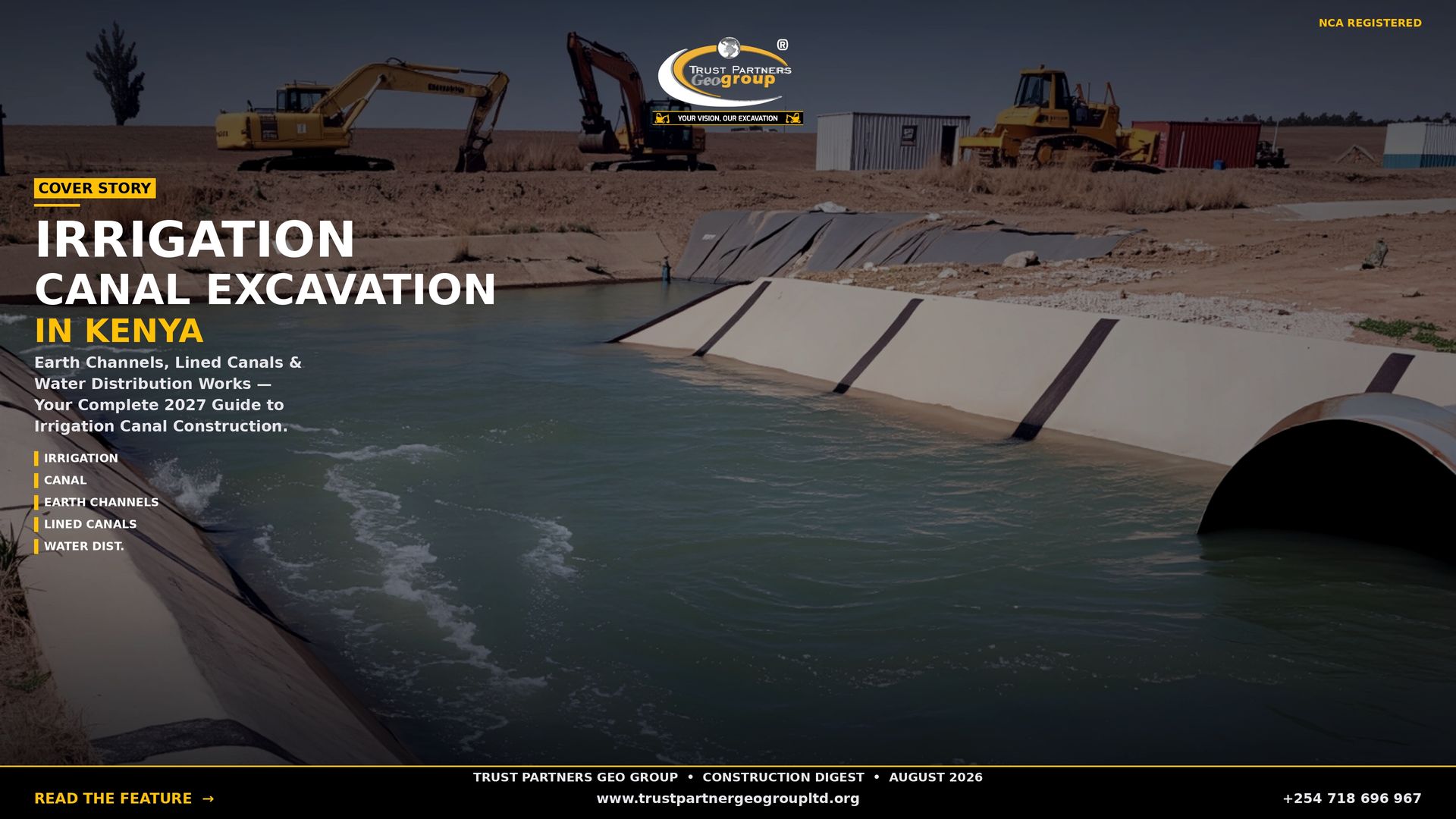
From the gravity-fed canals of Bura delivering Tana River water to 25,000 acres to the rice paddies of Mwea connected by 100+ km of channel network, Kenya's irrigation canals are the lifelines of its agricultural transformation. But behind every flowing canal lies a massive earthworks investment: trenches cut through black cotton soil, embankments raised above floodplains, trapezoidal sections formed to precision gradients, and concrete or masonry lining installed to stop the seepage that wastes 30–50% of conveyed water. This guide covers irrigation canal excavation in Kenya — earth channel construction, lined canal earthworks, water distribution systems and the National Irrigation Authority projects reshaping the country's food security.

NCA-registered excavation contractor with 15+ years of irrigation infrastructure earthworks across Kenya. We provide canal excavation, lining installation, desilting and water distribution construction for NIA, county government and private irrigation projects.
Types of Irrigation Canals in Kenya
Kenya's irrigation canal systems are classified by function, size and construction method into four main types:
Main Canals
Primary conveyance channels carrying water from the intake, reservoir or regulating pond to the distribution network. The Nyakach-Kano Main Canal extends 44.2 km from the Sondu-Miriu regulating pond, commanding 13,680 hectares. The Bura Gravity Main Canal runs 26 km from the Korakora intake on the Tana River. Typical dimensions: bottom width 3–20 metres, depth 1.5–2.8 metres, side slopes 1:1.5 (vertical:horizontal), longitudinal gradient 1/3,000 to 1/7,000. Main canals are increasingly concrete-lined to minimize seepage on long conveyance routes.
Secondary Canals
Branch off main canals to serve sub-areas or zones within a scheme. Kenya has over 250 secondary canals across NIA-managed schemes. Typically unlined trapezoidal channels 1–3 metres bottom width, 0.7–1.5 metres deep, with turnouts and measuring devices at each branch for equitable water distribution. Secondary canals often run parallel to farm roads, sharing embankments for efficient land use.
Tertiary Canals
Deliver water from secondary canals to field blocks or farm groups. Dimensions: 0.5–1.2 metres bottom width, 0.7–1.4 metres deep. Often lined with concrete or masonry to reduce seepage in the final distribution stage where water is most valuable. Tertiary canals include control structures — gates, weirs and division boxes — that allow precise allocation to individual farms.
Field Drains and Watercourses
The smallest channels delivering water directly to plots or removing excess water from fields. Dimensions: 0.2–1.2 metres bottom width, 0.2–1.3 metres deep. Can be earth channels, lined ditches or piped laterals. In rice schemes like Mwea and Ahero, field drains are as critical as supply canals — removing standing water at the right time for crop management.
Drainage Canals
Separate from supply canals but equally important. Drainage canals remove excess water from low-lying schemes, prevent waterlogging and control salinity. The Mwea scheme has extensive drainage networks parallel to irrigation canals. The Nyakach swamp area required 263 km of drainage canals to manage flood risk and improve agricultural productivity.
Canal Excavation and Earthworks Methods
Trust Partners Geo-Group deploys specialized equipment and methods for each canal type:
- Main canal excavation: Bulldozers clear vegetation and rough-grade the corridor. Long-reach excavators (30 ton) cut the trapezoidal section from one bank, minimizing ground disturbance. Spoil is used for embankment construction on the downhill side or hauled to disposal. GPS grade control maintains longitudinal gradient to within 2 cm over 1 km.
- Secondary canal excavation: Backhoe loaders and mini-excavators work in confined spaces where large machines cannot maneuver. Trapezoidal sections are formed with precision, and spoil is spread on adjacent embankments or farm roads.
- Tertiary and field canal excavation: Mini-excavators (5 ton) and manual labour excavate narrow channels between existing crops. Careful alignment preserves mature plants and minimizes farm disruption during growing seasons.
- Embankment construction: Spoil from excavation is spread in 200 mm layers and compacted with vibratory rollers to 90–95% Mod AASHTO density. Embankment side slopes are graded at 1:1.5 to 1:2 for stability. Top width of 2–3 metres accommodates maintenance access and service roads.
- Cut slope benching: On steep terrain or deep cuts, slopes are benched at 2–3 metre intervals to prevent collapse and allow grass establishment. In volcanic or rocky areas, rippers and breakers prepare the cut before excavation.
- Dewatering: In high-water-table areas like Mwea, Ahero and Bura, well-point dewatering or sump pumping maintains dry working conditions. Dewatering discharge requires Water Authority permits and sediment control.
Canal Lining Systems and Installation
Canal lining is critical in Kenya because unlined earth canals lose 30–50% of conveyed water to seepage, evaporation and weed transpiration. Lined canals reduce losses to 5–15%, effectively doubling irrigable area from the same source:
- Concrete lining: The most common in Kenya. Cast-in-place or precast concrete slabs (75–100 mm thick) form a smooth, durable surface with low Manning's n (0.013–0.015). Used for main canals, critical tertiary sections and structures. Requires formwork, reinforcement in expansive soils, and 7-day curing. Cost: KES 2,500–4,500 per m² of wetted perimeter.
- Masonry lining: Dressed stone or rubble masonry with mortar pointing. Used where aggregate is scarce but stone is abundant — common in Nyeri, Murang'a and Kericho. More labour-intensive but durable and repairable. Cost: KES 1,800–3,200 per m².
- Compacted clay lining: Low-cost alternative for secondary canals in clay-rich areas. Clay is excavated, processed to optimum moisture and compacted in 150 mm layers to form an impermeable barrier. Moderate seepage reduction at KES 400–700 per m². Requires ongoing maintenance and repair after dry-season cracking.
- Geomembrane (HDPE) lining: Increasingly used for farm ponds, small canals and water pans. Lightweight, impermeable and quick to install. Requires protective soil cover or concrete anchorage to prevent UV damage and puncture. Cost: KES 1,500–2,800 per m² including installation.
- Shotcrete lining: Sprayed concrete applied directly to prepared canal surfaces. Faster than cast-in-place for irregular sections and rocky cuts. Used for structure repairs and emergency reinforcement. Cost: KES 3,000–5,000 per m².
Irrigation Canal Excavation Rates 2027
| Service | Rate (KES) | Notes |
|---|---|---|
| Main canal earth excavation (per m³) | 400 – 800 | Bulldozer + excavator on wide terrain; unlined trapezoidal section |
| Secondary canal excavation (per m³) | 500 – 900 | Backhoe loader; moderate access |
| Tertiary/field canal excavation (per m³) | 600 – 1,200 | Mini-excavator + manual; confined between crops |
| Lined canal excavation + bedding (per m³) | 800 – 1,500 | Includes keyway, benching and subgrade preparation |
| Concrete canal lining (per m²) | 2,500 – 4,500 | Cast-in-place; incl. formwork, reinforcement, curing |
| Masonry canal lining (per m²) | 1,800 – 3,200 | Stone with mortar; labour-intensive |
| Compacted clay lining (per m²) | 400 – 700 | Clay processing and layered compaction |
| Geomembrane lining (per m²) | 1,500 – 2,800 | HDPE with protective cover and anchorage |
| Canal desilting/rehabilitation (per m³) | 300 – 600 | Silt removal and bank reshaping |
| Embankment construction (per m³) | 350 – 650 | Spoil placement and compaction in layers |
| Canal structure excavation (per unit) | 25,000 – 75,000 | Turnouts, division boxes, culverts, silt traps |
| Service road construction (per km) | 800,000 – 1,500,000 | Murram road on canal embankment |
| Dewatering (per site/day) | 8,000 – 18,000 | Pump hire, fuel, operator for wet sites |
Major NIA Canal Projects and Counties
| Project / County | Canal Scope | Status | Key Earthworks |
|---|---|---|---|
| Bura Gravity Tana River | 26 km main canal from Korakora intake; gravity-fed replacing pump system | Phase 1: 99% complete Phase 2: 60% complete | Intake excavation, 26 km canal cut-and-fill, siltation basin, secant piling |
| Mwea Irrigation Kirinyaga | Link Canal III, drainage canals, road networks, Kathiga bridge | Canal works: 90% Drainage/roads: 59% | Link canal excavation, drainage channel construction, bridge foundations |
| Sondu-Miriu Kisumu/Nyando | 44.2 km Nyakach-Kano main canal; 213 km secondary canals; 263 km drainage | Completed / operational | Regulating pond excavation, main canal trapezoidal sections, embankments |
| Lower River Lumi Taita Taveta | Desilting and auxiliary structures across multiple lots | 86–96% complete | Canal desilting, structure excavation, embankment repair |
| Murang'a Smallholder Murang'a | 15+ projects: Mirira, Nginda, Mukurwe, Maragwa Ridge with conveyance canals | 17–85% complete | Intake excavation, pipeline and canal trenches, distribution structures |
| Meru Irrigation Meru | Rumanti, Kamburu Mbeu, Iraru, Gamanti with intake and conveyance systems | 20–92% complete | Intake chambers, sedimentation basins, pipeline and canal excavation |
| Embu/Kirinyaga Embu/Kirinyaga | Kanyuambora, Iriari, Gatene, Kandeki with conveyance and distribution | 10–98% complete | Intake works, canal excavation, infield pipeline trenches |
| Machakos/Makueni Machakos/Makueni | Kisiiki, Yikitaa with canal and pipeline conveyance | 35–75% complete | Canal excavation, pump installation pads, distribution pipelines |
Canal Maintenance and Rehabilitation Challenges
Existing Kenyan irrigation canals face six persistent challenges that drive ongoing excavation and maintenance demand:
- Siltation: Canals conveying water from high-silt rivers like the Tana and Nyando accumulate sediment that reduces capacity by 20–40% within 2–3 years. The Bura scheme addresses this with a 15-metre wide siltation basin at the Korakora intake where velocity decrease allows suspended solids to deposit. Regular desilting of canals, basins and structures is essential.
- Weed infestation: Water hyacinth, papyrus and submerged weeds choke canals, reducing flow velocity and creating mosquito breeding habitats. Lined canals and concrete structures suppress weed growth; unlined canals require 2–3 manual clearings per year.
- Bank erosion and collapse: Unlined canals in expansive soils (black cotton) and sandy soils suffer bank collapse during wet seasons. The West Kano scheme experienced bank overflows upstream due to channel widening and underbrush, limiting water to downstream paddies.
- Seepage losses: Unlined earth canals lose 30–50% of water to seepage, particularly in porous volcanic soils and sandy alluvium. Lining or compacting canal walls improves Manning's value and optimizes flow velocity, eliminating siltation from low velocities.
- Structural damage: Turnouts, culverts, division boxes and bridges deteriorate from water pressure, traffic loads and poor maintenance. Replacement requires precise excavation, formwork and concrete placement.
- Capacity inadequacy: Many older schemes were designed for smaller command areas. Canal networks require widening and deepening to serve expanded irrigation. The West Kano scheme needed 40% capacity improvement through lining, channel regularization and removal of undulating bed depths.
Canal Excavation and Water Distribution Earthworks
Trust Partners Geo-Group provides irrigation canal excavation, lining installation, desilting and water distribution construction for NIA, county government and private irrigation projects across all 47 Kenyan counties. Free route survey and itemised quote.
Call +254 718 686 967 Email for QuoteFrequently Asked Questions
What types of irrigation canals are excavated in Kenya?
Kenya's irrigation canal systems use four main canal types classified by function and size: (1) Main canals — primary conveyance channels carrying water from the intake or reservoir to the distribution network. Typical dimensions: bottom width 3–20 metres, depth 1.5–2.8 metres, side slopes 1:1.5 (vertical:horizontal), longitudinal gradient 1/3,000 to 1/7,000. The Bura Gravity Main Canal is 26 km long; the Nyakach-Kano Main Canal extends 44.2 km. (2) Secondary canals — branch off main canals to serve sub-areas. Typically unlined trapezoidal channels 1–3 metres bottom width, 0.7–1.5 metres deep. Kenya has over 250 secondary canals across NIA schemes. (3) Tertiary canals — deliver water from secondary canals to field blocks. Dimensions: 0.5–1.2 metres bottom width, 0.7–1.4 metres deep. Often lined with concrete or masonry to reduce seepage. (4) Field drains and watercourses — the smallest channels delivering water directly to plots. Dimensions: 0.2–1.2 metres bottom width, 0.2–1.3 metres deep. Can be earth channels, lined ditches or piped laterals. Additionally, Kenya uses drainage canals to remove excess water from low-lying schemes — particularly critical in the Nyakach swamp area and Mwea rice scheme.
How much does irrigation canal excavation cost in Kenya?
Irrigation canal excavation costs in Kenya vary by canal type, soil conditions, lining requirements and access. Earth channel excavation (unlined) costs KES 400–800 per m³ for main and secondary canals using bulldozers and backhoes on wide terrain. Tertiary and field canal excavation in confined spaces costs KES 600–1,200 per m³ using mini-excavators and manual labour. Lined canal excavation costs KES 800–1,500 per m³ — includes forming trapezoidal sections, bedding preparation and keyway excavation for concrete or masonry lining. Concrete lining placement costs KES 2,500–4,500 per m² of wetted perimeter. Masonry lining with stone costs KES 1,800–3,200 per m². Canal desilting and rehabilitation costs KES 300–600 per m³ of silt removed. Key cost components per km of main canal: earthworks KES 3–8 million; lining KES 8–15 million; structures (turnouts, culverts, bridges) KES 2–5 million; and service roads KES 1–3 million. Cost drivers include: soil type (rock breaking in volcanic areas adds 50–100%), water table (dewatering in swampy areas adds costs), haul distance for lining aggregates, and seasonal access (wet season work extends timelines by 30–40%). The Bura Gravity Canal project (26 km) represents one of Kenya's largest recent canal earthworks investments. Trust Partners Geo-Group provides fixed-price quotes for canal excavation after topographic survey and soil assessment.
What equipment is used for irrigation canal excavation?
Irrigation canal excavation in Kenya requires specialized earthmoving equipment scaled to canal size and terrain: (1) Bulldozers — for clearing vegetation, rough grading and pushing spoil on main and secondary canal corridors. Essential for wide, open terrain. (2) 20–30 ton excavators with long-reach arms — for main canal excavation, benching cut slopes and forming trapezoidal sections. Long-reach arms access the full channel width from one bank, minimizing ground disturbance. (3) Backhoe loaders — for secondary and tertiary canal excavation in confined spaces where large excavators cannot maneuver. (4) Mini-excavators (5 ton) — for tertiary canals, field drains and precision work near existing crops or structures. (5) Motor graders — for forming canal embankments, profiling service roads and achieving precise longitudinal gradients. (6) Vibratory rollers — for compacting canal embankments and service roads to 95% Mod AASHTO density. (7) Dump trucks — for hauling excess spoil to disposal sites or importing lining aggregates and filter materials. (8) Concrete equipment — portable mixers, vibrators and formwork for lining placement and structure construction. (9) Dewatering pumps — for maintaining dry working conditions in high-water-table areas like Mwea, Ahero and Bura. All Trust Partners Geo-Group canal excavation equipment is available wet hire with NITA-certified operators experienced in irrigation infrastructure earthworks.
Why do canals need lining in Kenya?
Canal lining is critical in Kenya because unlined earth canals lose 30–50% of conveyed water to seepage, evaporation and weed transpiration. In a country where water scarcity affects 40% of agricultural land, these losses are unsustainable. Lined canals reduce conveyance losses to 5–15%, effectively doubling the irrigable area from the same water source. Concrete lining is the most common in Kenya — durable, smooth (low Manning's n value of 0.013–0.015), and resistant to weed growth. It is used for main canals, tertiary canals and critical sections. Masonry lining with dressed stone is used where aggregate is scarce but stone is abundant — common in Nyeri, Murang'a and Kericho. Compacted clay lining is a low-cost alternative for secondary canals in clay-rich areas, achieving moderate seepage reduction at KES 400–700 per m². Geomembrane (HDPE) lining is increasingly used for farm ponds and small canals — lightweight, impermeable and quick to install. Lining also prevents canal bank collapse in expansive soils, reduces maintenance by suppressing weed growth, and improves flow velocity to prevent siltation. The National Irrigation Authority increasingly mandates lining for all new canal construction and rehabilitation projects.
Which counties have the most irrigation canal construction in Kenya?
Irrigation canal construction is concentrated in Kenya's major irrigation schemes and emerging projects: (1) Kirinyaga (Mwea) — Kenya's largest rice irrigation scheme with over 100 km of main, secondary and tertiary canals serving 25,000+ acres. Recent NIA projects include Link Canal III construction and drainage canal improvements. (2) Tana River (Bura) — the Bura Gravity Irrigation Scheme features a 26 km main canal from Korakora intake, with capacity to irrigate 25,000 acres. One of Kenya's most significant recent canal earthworks projects. (3) Kisumu/Nyando (Ahero, West Kano) — sugarcane and rice schemes with extensive canal networks. The Sondu-Miriu project includes 44.2 km of main canal and 213 km of secondary canals. (4) Taita Taveta — multiple rehabilitation projects including Lower River Lumi, Murabani, Njukini and Tuhire Challa schemes with canal lining and desilting works. (5) Murang'a — over 15 smallholder irrigation projects including Mirira, Nginda, Mukurwe wa Nyagathanga and Maragwa Ridge with conveyance pipelines and canal systems. (6) Meru — Rumanti, Kamburu Mbeu, Iraru and Gamanti irrigation projects with intake works, conveyance canals and distribution networks. (7) Embu — Kanyuambora, Iriari and Gatene irrigation projects with canal construction and rehabilitation. (8) Machakos/Makueni — Kisiiki and Yikitaa projects with canal and pipeline conveyance systems. Trust Partners Geo-Group has completed canal earthworks in 15+ counties for NIA, county government and private irrigation developments.
What are the main challenges in canal excavation and maintenance?
Kenyan irrigation canals face six persistent challenges that drive excavation and maintenance demand: (1) Siltation — canals conveying water from high-silt rivers like the Tana and Nyando accumulate sediment that reduces capacity by 20–40% within 2–3 years. Regular desilting is essential; the Bura scheme includes a dedicated siltation basin at the intake. (2) Weed infestation — water hyacinth, papyrus and submerged weeds choke canals, reducing flow velocity and creating mosquito breeding habitats. Lined canals and concrete structures suppress weed growth. (3) Bank erosion and collapse — unlined canals in expansive soils (black cotton) and sandy soils suffer bank collapse during wet seasons, requiring re-excavation and stabilization. (4) Seepage losses — unlined earth canals lose 30–50% of water to seepage, particularly in porous volcanic soils and sandy alluvium. (5) Structural damage — turnouts, culverts and bridges deteriorate from water pressure, traffic loads and poor maintenance. Replacement requires precise excavation and concrete work. (6) Capacity inadequacy — many older schemes were designed for smaller command areas. Canal networks require widening and deepening to serve expanded irrigation — the West Kano scheme needed 40% capacity improvement through lining and channel regularization. Trust Partners Geo-Group addresses all these challenges through precision excavation, lining installation, desilting and structural rehabilitation.
How long does irrigation canal excavation take?
Irrigation canal excavation timelines depend on canal size, terrain, equipment and season. A 1 km main canal section on flat terrain with bulldozers and excavators takes 2–3 weeks: 3–4 days clearing, 5–7 days excavation and embankment forming, 3–4 days compaction and grading, and 3–5 days lining preparation. A 1 km secondary canal with mini-excavators and manual labour takes 3–4 weeks. Concrete lining placement adds 2–3 weeks per km depending on crew size and curing time. Large NIA projects like the Bura Gravity Canal (26 km) required multi-year phased construction with dedicated fleets. Seasonal factors: dry season (January–March, June–September) is optimal — stable soils, manageable water tables and predictable concrete curing. Wet season work extends timelines by 30–50% due to saturated banks, flooding risk and difficult access. In high-water-table areas like Mwea and Ahero, dewatering is required throughout construction, adding 20–30% to duration. Trust Partners Geo-Group schedules canal earthworks to maximize dry-season productivity and maintains dewatering equipment for all-weather sites.
What permits are required for irrigation canal construction in Kenya?
Irrigation canal construction in Kenya requires a layered permit approach: (1) National Irrigation Authority (NIA) approval — all irrigation projects using public water or receiving government funding require NIA technical review and approval. NIA oversees design standards, water allocation and project integration with national irrigation strategy. (2) Water Authority permit — required for water abstraction from rivers, lakes or groundwater for irrigation. Includes environmental flow requirements and abstraction limits. (3) NEMA Environmental Impact Assessment — mandatory for canals over 5 km, projects near wetlands or Ramsar sites, or schemes affecting more than 1,000 hectares. The Bura Gravity Scheme required full EIA due to Tana River impacts. (4) County government approval — required for land use change, construction on county land, and integration with county agricultural plans. (5) Kenya Forest Service (KFS) — required if canals pass through forest reserves or indigenous forest, common in Mount Kenya and Aberdare catchments. (6) Public land clearance — for canals crossing community land, group ranches or trust land, community consent and land board approval are required. (7) KeRRA/KeNHA coordination — where irrigation service roads connect to public road networks. Trust Partners Geo-Group coordinates all permit requirements for irrigation canal projects, working with NIA, Water Authority, NEMA, county governments and KFS to ensure compliant earthworks execution.
Related Resources
Start Your Irrigation Canal Excavation Project
Contact Trust Partners Geo-Group at +254 718 686 967 for a free canal route survey and itemised earthworks quote. Serving NIA projects, county irrigation schemes and private developments across all 47 counties.
Call +254 718 686 967 Request QuoteIrrigation Canal Excavation in Kenya: Earth Channels, Lined Canals and Water Distribution Works [2027]
Canal Construction, Desilting and Water Distribution Earthworks for Kenya's National Irrigation Infrastructure
From the gravity-fed canals of Bura delivering Tana River water to 25,000 acres to the rice paddies of Mwea connected by 100+ km of channel network, Kenya's irrigation canals are the lifelines of its agricultural transformation. But behind every flowing canal lies a massive earthworks investment: trenches cut through black cotton soil, embankments raised above floodplains, trapezoidal sections formed to precision gradients, and concrete or masonry lining installed to stop the seepage that wastes 30–50% of conveyed water. This guide covers irrigation canal excavation in Kenya — earth channel construction, lined canal earthworks, water distribution systems and the National Irrigation Authority projects reshaping the country's food security.
NCA-registered excavation contractor with 15+ years of irrigation infrastructure earthworks across Kenya. We provide canal excavation, lining installation, desilting and water distribution construction for NIA, county government and private irrigation projects.
Types of Irrigation Canals in Kenya
Kenya's irrigation canal systems are classified by function, size and construction method into four main types:
Main Canals
Primary conveyance channels carrying water from the intake, reservoir or regulating pond to the distribution network. The Nyakach-Kano Main Canal extends 44.2 km from the Sondu-Miriu regulating pond, commanding 13,680 hectares. The Bura Gravity Main Canal runs 26 km from the Korakora intake on the Tana River. Typical dimensions: bottom width 3–20 metres, depth 1.5–2.8 metres, side slopes 1:1.5 (vertical:horizontal), longitudinal gradient 1/3,000 to 1/7,000. Main canals are increasingly concrete-lined to minimize seepage on long conveyance routes.
Secondary Canals
Branch off main canals to serve sub-areas or zones within a scheme. Kenya has over 250 secondary canals across NIA-managed schemes. Typically unlined trapezoidal channels 1–3 metres bottom width, 0.7–1.5 metres deep, with turnouts and measuring devices at each branch for equitable water distribution. Secondary canals often run parallel to farm roads, sharing embankments for efficient land use.
Tertiary Canals
Deliver water from secondary canals to field blocks or farm groups. Dimensions: 0.5–1.2 metres bottom width, 0.7–1.4 metres deep. Often lined with concrete or masonry to reduce seepage in the final distribution stage where water is most valuable. Tertiary canals include control structures — gates, weirs and division boxes — that allow precise allocation to individual farms.
Field Drains and Watercourses
The smallest channels delivering water directly to plots or removing excess water from fields. Dimensions: 0.2–1.2 metres bottom width, 0.2–1.3 metres deep. Can be earth channels, lined ditches or piped laterals. In rice schemes like Mwea and Ahero, field drains are as critical as supply canals — removing standing water at the right time for crop management.
Drainage Canals
Separate from supply canals but equally important. Drainage canals remove excess water from low-lying schemes, prevent waterlogging and control salinity. The Mwea scheme has extensive drainage networks parallel to irrigation canals. The Nyakach swamp area required 263 km of drainage canals to manage flood risk and improve agricultural productivity.
Canal Excavation and Earthworks Methods
Trust Partners Geo-Group deploys specialized equipment and methods for each canal type:
- Main canal excavation: Bulldozers clear vegetation and rough-grade the corridor. Long-reach excavators (30 ton) cut the trapezoidal section from one bank, minimizing ground disturbance. Spoil is used for embankment construction on the downhill side or hauled to disposal. GPS grade control maintains longitudinal gradient to within 2 cm over 1 km.
- Secondary canal excavation: Backhoe loaders and mini-excavators work in confined spaces where large machines cannot maneuver. Trapezoidal sections are formed with precision, and spoil is spread on adjacent embankments or farm roads.
- Tertiary and field canal excavation: Mini-excavators (5 ton) and manual labour excavate narrow channels between existing crops. Careful alignment preserves mature plants and minimizes farm disruption during growing seasons.
- Embankment construction: Spoil from excavation is spread in 200 mm layers and compacted with vibratory rollers to 90–95% Mod AASHTO density. Embankment side slopes are graded at 1:1.5 to 1:2 for stability. Top width of 2–3 metres accommodates maintenance access and service roads.
- Cut slope benching: On steep terrain or deep cuts, slopes are benched at 2–3 metre intervals to prevent collapse and allow grass establishment. In volcanic or rocky areas, rippers and breakers prepare the cut before excavation.
- Dewatering: In high-water-table areas like Mwea, Ahero and Bura, well-point dewatering or sump pumping maintains dry working conditions. Dewatering discharge requires Water Authority permits and sediment control.
Canal Lining Systems and Installation
Canal lining is critical in Kenya because unlined earth canals lose 30–50% of conveyed water to seepage, evaporation and weed transpiration. Lined canals reduce losses to 5–15%, effectively doubling irrigable area from the same source:
- Concrete lining: The most common in Kenya. Cast-in-place or precast concrete slabs (75–100 mm thick) form a smooth, durable surface with low Manning's n (0.013–0.015). Used for main canals, critical tertiary sections and structures. Requires formwork, reinforcement in expansive soils, and 7-day curing. Cost: KES 2,500–4,500 per m² of wetted perimeter.
- Masonry lining: Dressed stone or rubble masonry with mortar pointing. Used where aggregate is scarce but stone is abundant — common in Nyeri, Murang'a and Kericho. More labour-intensive but durable and repairable. Cost: KES 1,800–3,200 per m².
- Compacted clay lining: Low-cost alternative for secondary canals in clay-rich areas. Clay is excavated, processed to optimum moisture and compacted in 150 mm layers to form an impermeable barrier. Moderate seepage reduction at KES 400–700 per m². Requires ongoing maintenance and repair after dry-season cracking.
- Geomembrane (HDPE) lining: Increasingly used for farm ponds, small canals and water pans. Lightweight, impermeable and quick to install. Requires protective soil cover or concrete anchorage to prevent UV damage and puncture. Cost: KES 1,500–2,800 per m² including installation.
- Shotcrete lining: Sprayed concrete applied directly to prepared canal surfaces. Faster than cast-in-place for irregular sections and rocky cuts. Used for structure repairs and emergency reinforcement. Cost: KES 3,000–5,000 per m².
Irrigation Canal Excavation Rates 2027
| Service | Rate (KES) | Notes |
|---|---|---|
| Main canal earth excavation (per m³) | 400 – 800 | Bulldozer + excavator on wide terrain; unlined trapezoidal section |
| Secondary canal excavation (per m³) | 500 – 900 | Backhoe loader; moderate access |
| Tertiary/field canal excavation (per m³) | 600 – 1,200 | Mini-excavator + manual; confined between crops |
| Lined canal excavation + bedding (per m³) | 800 – 1,500 | Includes keyway, benching and subgrade preparation |
| Concrete canal lining (per m²) | 2,500 – 4,500 | Cast-in-place; incl. formwork, reinforcement, curing |
| Masonry canal lining (per m²) | 1,800 – 3,200 | Stone with mortar; labour-intensive |
| Compacted clay lining (per m²) | 400 – 700 | Clay processing and layered compaction |
| Geomembrane lining (per m²) | 1,500 – 2,800 | HDPE with protective cover and anchorage |
| Canal desilting/rehabilitation (per m³) | 300 – 600 | Silt removal and bank reshaping |
| Embankment construction (per m³) | 350 – 650 | Spoil placement and compaction in layers |
| Canal structure excavation (per unit) | 25,000 – 75,000 | Turnouts, division boxes, culverts, silt traps |
| Service road construction (per km) | 800,000 – 1,500,000 | Murram road on canal embankment |
| Dewatering (per site/day) | 8,000 – 18,000 | Pump hire, fuel, operator for wet sites |
Major NIA Canal Projects and Counties
| Project / County | Canal Scope | Status | Key Earthworks |
|---|---|---|---|
| Bura Gravity Tana River | 26 km main canal from Korakora intake; gravity-fed replacing pump system | Phase 1: 99% complete Phase 2: 60% complete | Intake excavation, 26 km canal cut-and-fill, siltation basin, secant piling |
| Mwea Irrigation Kirinyaga | Link Canal III, drainage canals, road networks, Kathiga bridge | Canal works: 90% Drainage/roads: 59% | Link canal excavation, drainage channel construction, bridge foundations |
| Sondu-Miriu Kisumu/Nyando | 44.2 km Nyakach-Kano main canal; 213 km secondary canals; 263 km drainage | Completed / operational | Regulating pond excavation, main canal trapezoidal sections, embankments |
| Lower River Lumi Taita Taveta | Desilting and auxiliary structures across multiple lots | 86–96% complete | Canal desilting, structure excavation, embankment repair |
| Murang'a Smallholder Murang'a | 15+ projects: Mirira, Nginda, Mukurwe, Maragwa Ridge with conveyance canals | 17–85% complete | Intake excavation, pipeline and canal trenches, distribution structures |
| Meru Irrigation Meru | Rumanti, Kamburu Mbeu, Iraru, Gamanti with intake and conveyance systems | 20–92% complete | Intake chambers, sedimentation basins, pipeline and canal excavation |
| Embu/Kirinyaga Embu/Kirinyaga | Kanyuambora, Iriari, Gatene, Kandeki with conveyance and distribution | 10–98% complete | Intake works, canal excavation, infield pipeline trenches |
| Machakos/Makueni Machakos/Makueni | Kisiiki, Yikitaa with canal and pipeline conveyance | 35–75% complete | Canal excavation, pump installation pads, distribution pipelines |
Canal Maintenance and Rehabilitation Challenges
Existing Kenyan irrigation canals face six persistent challenges that drive ongoing excavation and maintenance demand:
- Siltation: Canals conveying water from high-silt rivers like the Tana and Nyando accumulate sediment that reduces capacity by 20–40% within 2–3 years. The Bura scheme addresses this with a 15-metre wide siltation basin at the Korakora intake where velocity decrease allows suspended solids to deposit. Regular desilting of canals, basins and structures is essential.
- Weed infestation: Water hyacinth, papyrus and submerged weeds choke canals, reducing flow velocity and creating mosquito breeding habitats. Lined canals and concrete structures suppress weed growth; unlined canals require 2–3 manual clearings per year.
- Bank erosion and collapse: Unlined canals in expansive soils (black cotton) and sandy soils suffer bank collapse during wet seasons. The West Kano scheme experienced bank overflows upstream due to channel widening and underbrush, limiting water to downstream paddies.
- Seepage losses: Unlined earth canals lose 30–50% of water to seepage, particularly in porous volcanic soils and sandy alluvium. Lining or compacting canal walls improves Manning's value and optimizes flow velocity, eliminating siltation from low velocities.
- Structural damage: Turnouts, culverts, division boxes and bridges deteriorate from water pressure, traffic loads and poor maintenance. Replacement requires precise excavation, formwork and concrete placement.
- Capacity inadequacy: Many older schemes were designed for smaller command areas. Canal networks require widening and deepening to serve expanded irrigation. The West Kano scheme needed 40% capacity improvement through lining, channel regularization and removal of undulating bed depths.
Canal Excavation and Water Distribution Earthworks
Trust Partners Geo-Group provides irrigation canal excavation, lining installation, desilting and water distribution construction for NIA, county government and private irrigation projects across all 47 Kenyan counties. Free route survey and itemised quote.
Call +254 718 686 967 Email for QuoteFrequently Asked Questions
What types of irrigation canals are excavated in Kenya?
Kenya's irrigation canal systems use four main canal types classified by function and size: (1) Main canals — primary conveyance channels carrying water from the intake or reservoir to the distribution network. Typical dimensions: bottom width 3–20 metres, depth 1.5–2.8 metres, side slopes 1:1.5 (vertical:horizontal), longitudinal gradient 1/3,000 to 1/7,000. The Bura Gravity Main Canal is 26 km long; the Nyakach-Kano Main Canal extends 44.2 km. (2) Secondary canals — branch off main canals to serve sub-areas. Typically unlined trapezoidal channels 1–3 metres bottom width, 0.7–1.5 metres deep. Kenya has over 250 secondary canals across NIA schemes. (3) Tertiary canals — deliver water from secondary canals to field blocks. Dimensions: 0.5–1.2 metres bottom width, 0.7–1.4 metres deep. Often lined with concrete or masonry to reduce seepage. (4) Field drains and watercourses — the smallest channels delivering water directly to plots. Dimensions: 0.2–1.2 metres bottom width, 0.2–1.3 metres deep. Can be earth channels, lined ditches or piped laterals. Additionally, Kenya uses drainage canals to remove excess water from low-lying schemes — particularly critical in the Nyakach swamp area and Mwea rice scheme.
How much does irrigation canal excavation cost in Kenya?
Irrigation canal excavation costs in Kenya vary by canal type, soil conditions, lining requirements and access. Earth channel excavation (unlined) costs KES 400–800 per m³ for main and secondary canals using bulldozers and backhoes on wide terrain. Tertiary and field canal excavation in confined spaces costs KES 600–1,200 per m³ using mini-excavators and manual labour. Lined canal excavation costs KES 800–1,500 per m³ — includes forming trapezoidal sections, bedding preparation and keyway excavation for concrete or masonry lining. Concrete lining placement costs KES 2,500–4,500 per m² of wetted perimeter. Masonry lining with stone costs KES 1,800–3,200 per m². Canal desilting and rehabilitation costs KES 300–600 per m³ of silt removed. Key cost components per km of main canal: earthworks KES 3–8 million; lining KES 8–15 million; structures (turnouts, culverts, bridges) KES 2–5 million; and service roads KES 1–3 million. Cost drivers include: soil type (rock breaking in volcanic areas adds 50–100%), water table (dewatering in swampy areas adds costs), haul distance for lining aggregates, and seasonal access (wet season work extends timelines by 30–40%). The Bura Gravity Canal project (26 km) represents one of Kenya's largest recent canal earthworks investments. Trust Partners Geo-Group provides fixed-price quotes for canal excavation after topographic survey and soil assessment.
What equipment is used for irrigation canal excavation?
Irrigation canal excavation in Kenya requires specialized earthmoving equipment scaled to canal size and terrain: (1) Bulldozers — for clearing vegetation, rough grading and pushing spoil on main and secondary canal corridors. Essential for wide, open terrain. (2) 20–30 ton excavators with long-reach arms — for main canal excavation, benching cut slopes and forming trapezoidal sections. Long-reach arms access the full channel width from one bank, minimizing ground disturbance. (3) Backhoe loaders — for secondary and tertiary canal excavation in confined spaces where large excavators cannot maneuver. (4) Mini-excavators (5 ton) — for tertiary canals, field drains and precision work near existing crops or structures. (5) Motor graders — for forming canal embankments, profiling service roads and achieving precise longitudinal gradients. (6) Vibratory rollers — for compacting canal embankments and service roads to 95% Mod AASHTO density. (7) Dump trucks — for hauling excess spoil to disposal sites or importing lining aggregates and filter materials. (8) Concrete equipment — portable mixers, vibrators and formwork for lining placement and structure construction. (9) Dewatering pumps — for maintaining dry working conditions in high-water-table areas like Mwea, Ahero and Bura. All Trust Partners Geo-Group canal excavation equipment is available wet hire with NITA-certified operators experienced in irrigation infrastructure earthworks.
Why do canals need lining in Kenya?
Canal lining is critical in Kenya because unlined earth canals lose 30–50% of conveyed water to seepage, evaporation and weed transpiration. In a country where water scarcity affects 40% of agricultural land, these losses are unsustainable. Lined canals reduce conveyance losses to 5–15%, effectively doubling the irrigable area from the same water source. Concrete lining is the most common in Kenya — durable, smooth (low Manning's n value of 0.013–0.015), and resistant to weed growth. It is used for main canals, tertiary canals and critical sections. Masonry lining with dressed stone is used where aggregate is scarce but stone is abundant — common in Nyeri, Murang'a and Kericho. Compacted clay lining is a low-cost alternative for secondary canals in clay-rich areas, achieving moderate seepage reduction at KES 400–700 per m². Geomembrane (HDPE) lining is increasingly used for farm ponds and small canals — lightweight, impermeable and quick to install. Lining also prevents canal bank collapse in expansive soils, reduces maintenance by suppressing weed growth, and improves flow velocity to prevent siltation. The National Irrigation Authority increasingly mandates lining for all new canal construction and rehabilitation projects.
Which counties have the most irrigation canal construction in Kenya?
Irrigation canal construction is concentrated in Kenya's major irrigation schemes and emerging projects: (1) Kirinyaga (Mwea) — Kenya's largest rice irrigation scheme with over 100 km of main, secondary and tertiary canals serving 25,000+ acres. Recent NIA projects include Link Canal III construction and drainage canal improvements. (2) Tana River (Bura) — the Bura Gravity Irrigation Scheme features a 26 km main canal from Korakora intake, with capacity to irrigate 25,000 acres. One of Kenya's most significant recent canal earthworks projects. (3) Kisumu/Nyando (Ahero, West Kano) — sugarcane and rice schemes with extensive canal networks. The Sondu-Miriu project includes 44.2 km of main canal and 213 km of secondary canals. (4) Taita Taveta — multiple rehabilitation projects including Lower River Lumi, Murabani, Njukini and Tuhire Challa schemes with canal lining and desilting works. (5) Murang'a — over 15 smallholder irrigation projects including Mirira, Nginda, Mukurwe wa Nyagathanga and Maragwa Ridge with conveyance pipelines and canal systems. (6) Meru — Rumanti, Kamburu Mbeu, Iraru and Gamanti irrigation projects with intake works, conveyance canals and distribution networks. (7) Embu — Kanyuambora, Iriari and Gatene irrigation projects with canal construction and rehabilitation. (8) Machakos/Makueni — Kisiiki and Yikitaa projects with canal and pipeline conveyance systems. Trust Partners Geo-Group has completed canal earthworks in 15+ counties for NIA, county government and private irrigation developments.
What are the main challenges in canal excavation and maintenance?
Kenyan irrigation canals face six persistent challenges that drive excavation and maintenance demand: (1) Siltation — canals conveying water from high-silt rivers like the Tana and Nyando accumulate sediment that reduces capacity by 20–40% within 2–3 years. Regular desilting is essential; the Bura scheme includes a dedicated siltation basin at the intake. (2) Weed infestation — water hyacinth, papyrus and submerged weeds choke canals, reducing flow velocity and creating mosquito breeding habitats. Lined canals and concrete structures suppress weed growth. (3) Bank erosion and collapse — unlined canals in expansive soils (black cotton) and sandy soils suffer bank collapse during wet seasons, requiring re-excavation and stabilization. (4) Seepage losses — unlined earth canals lose 30–50% of water to seepage, particularly in porous volcanic soils and sandy alluvium. (5) Structural damage — turnouts, culverts and bridges deteriorate from water pressure, traffic loads and poor maintenance. Replacement requires precise excavation and concrete work. (6) Capacity inadequacy — many older schemes were designed for smaller command areas. Canal networks require widening and deepening to serve expanded irrigation — the West Kano scheme needed 40% capacity improvement through lining and channel regularization. Trust Partners Geo-Group addresses all these challenges through precision excavation, lining installation, desilting and structural rehabilitation.
How long does irrigation canal excavation take?
Irrigation canal excavation timelines depend on canal size, terrain, equipment and season. A 1 km main canal section on flat terrain with bulldozers and excavators takes 2–3 weeks: 3–4 days clearing, 5–7 days excavation and embankment forming, 3–4 days compaction and grading, and 3–5 days lining preparation. A 1 km secondary canal with mini-excavators and manual labour takes 3–4 weeks. Concrete lining placement adds 2–3 weeks per km depending on crew size and curing time. Large NIA projects like the Bura Gravity Canal (26 km) required multi-year phased construction with dedicated fleets. Seasonal factors: dry season (January–March, June–September) is optimal — stable soils, manageable water tables and predictable concrete curing. Wet season work extends timelines by 30–50% due to saturated banks, flooding risk and difficult access. In high-water-table areas like Mwea and Ahero, dewatering is required throughout construction, adding 20–30% to duration. Trust Partners Geo-Group schedules canal earthworks to maximize dry-season productivity and maintains dewatering equipment for all-weather sites.
What permits are required for irrigation canal construction in Kenya?
Irrigation canal construction in Kenya requires a layered permit approach: (1) National Irrigation Authority (NIA) approval — all irrigation projects using public water or receiving government funding require NIA technical review and approval. NIA oversees design standards, water allocation and project integration with national irrigation strategy. (2) Water Authority permit — required for water abstraction from rivers, lakes or groundwater for irrigation. Includes environmental flow requirements and abstraction limits. (3) NEMA Environmental Impact Assessment — mandatory for canals over 5 km, projects near wetlands or Ramsar sites, or schemes affecting more than 1,000 hectares. The Bura Gravity Scheme required full EIA due to Tana River impacts. (4) County government approval — required for land use change, construction on county land, and integration with county agricultural plans. (5) Kenya Forest Service (KFS) — required if canals pass through forest reserves or indigenous forest, common in Mount Kenya and Aberdare catchments. (6) Public land clearance — for canals crossing community land, group ranches or trust land, community consent and land board approval are required. (7) KeRRA/KeNHA coordination — where irrigation service roads connect to public road networks. Trust Partners Geo-Group coordinates all permit requirements for irrigation canal projects, working with NIA, Water Authority, NEMA, county governments and KFS to ensure compliant earthworks execution.
Related Resources
Start Your Irrigation Canal Excavation Project
Contact Trust Partners Geo-Group at +254 718 686 967 for a free canal route survey and itemised earthworks quote. Serving NIA projects, county irrigation schemes and private developments across all 47 counties.
Call +254 718 686 967 Request Quote