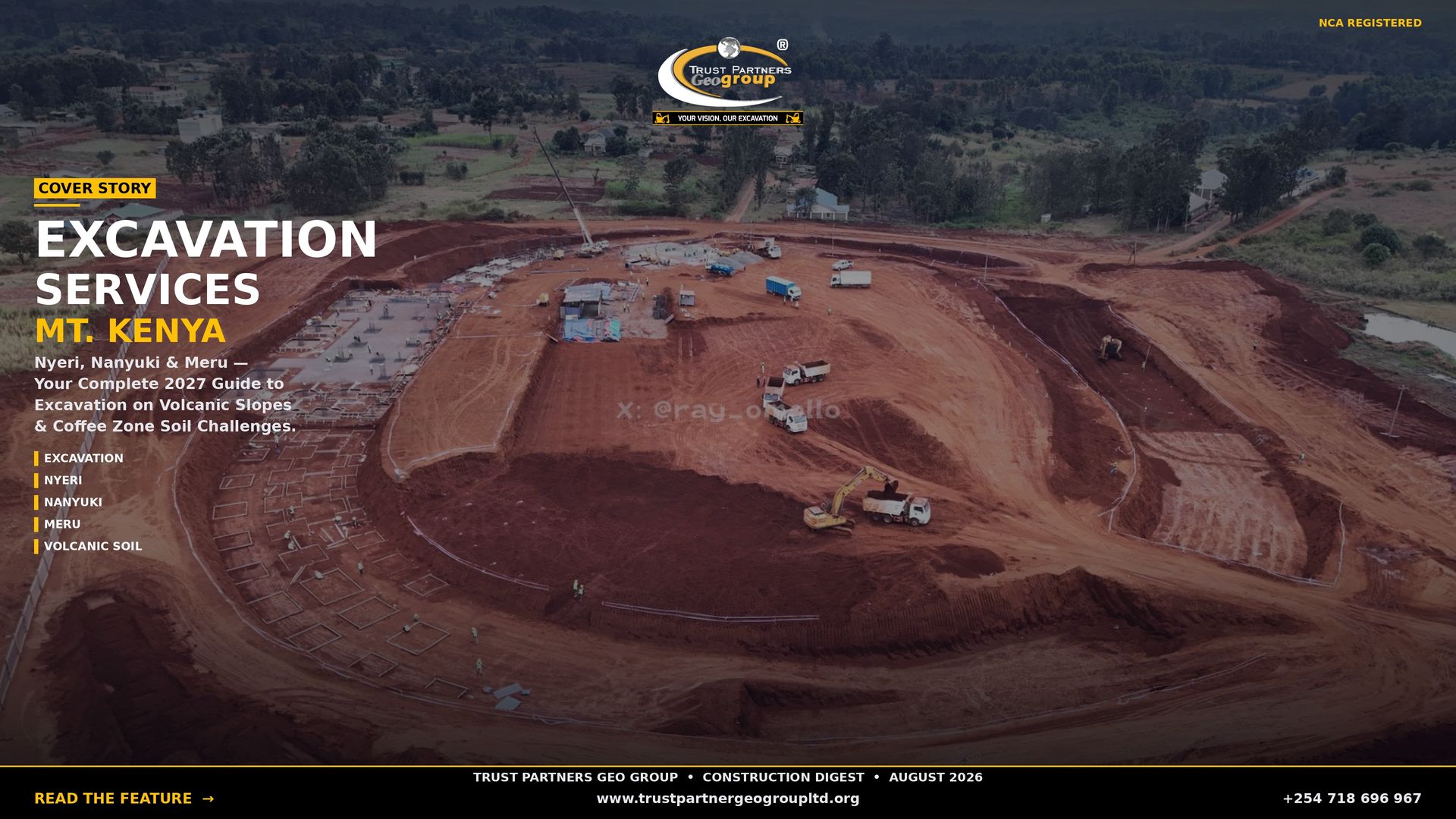
Excavation Services in Nyeri, Nanyuki and Meru: Mount Kenya Volcanic Slope and Coffee Zone Soil Challenges [2027]
Hillside Benching, Foundation Excavation & Earthworks for Central Kenya's Mount Kenya Highlands
In the shadow of Africa's second-highest peak, three towns are reshaping central Kenya's construction landscape. Nyeri, Nanyuki and Meru — historic coffee towns, colonial settler outposts and gateway communities to Mount Kenya — now form one of Kenya's most geographically challenging growth corridors. But beneath the manicured coffee bushes and indigenous forest canopy lies a terrain that demands respect: steep volcanic slopes that require extensive benching, deep andosols that hide shallow bedrock, year-round rainfall that turns excavations into mudslides, and high-altitude conditions that slow every phase of construction. This guide covers everything developers need to know about Mount Kenya highland excavation — from hillside stabilization and coffee zone site preparation to county permits and 2027 hire rates.

NCA-registered excavation and heavy equipment hire contractor with 15+ years operating across Kenya. We provide hillside benching, volcanic slope excavation and highland earthworks for Nyeri, Nanyuki, Meru and all Mount Kenya region projects.
Why Nyeri, Nanyuki and Meru Are Expanding
The Mount Kenya highlands are experiencing sustained growth driven by seven key factors:
- Mount Kenya tourism gateway: Nanyuki is the primary access point for Mount Kenya National Park, Sirimon Route, Naro Moru Route and the Aberdare Range. Hotels, eco-lodges, safari camps, climbing hostels and retirement estates attract both domestic and international investment year-round.
- Nyeri agricultural wealth: The Nyeri highlands produce some of Kenya's finest coffee, tea and dairy. Agricultural processing plants, cooperative society headquarters, cold storage facilities and farmer training centres drive continuous construction in the coffee zone.
- Meru commercial and educational hub: Meru town anchors Kenya's eastern highlands with county government offices, Meru University of Science and Technology, and a booming retail and residential sector. The town is expanding rapidly toward the Nyambene Hills.
- Affordable highland land: A 50×100 ft plot in Nyeri costs KES 2–4 million, Nanyuki plots range KES 2.5–5 million (premium near the park), and Meru offers land at KES 1.5–3.5 million. Comparable plots in Nairobi cost 3–5× more.
- Climate and lifestyle appeal: The 1,600–2,000 metre elevation delivers cool temperatures (12–22°C), clean mountain air and panoramic views that attract retirement homes, boarding schools, hospitals and wellness retreats.
- Devolution infrastructure: Nyeri, Laikipia and Meru county governments have invested in tarmac roads, modern markets, stadiums and health facilities — opening new zones for development.
- Transport connectivity: The Nairobi-Nanyuki railway revival, the Nyeri-Nairobi highway upgrade and improved feeder roads have reduced travel times and unlocked previously remote highland areas.
The Mount Kenya Soil Challenge: Volcanic Slopes and Coffee Zone Terrain
The Mount Kenya region sits on volcanic soils derived from the stratovolcano itself — some of the most agriculturally prized but construction-challenging soils in Kenya:
- Andosols (volcanic ash soils): The dominant soil on Mount Kenya's slopes is deep, dark volcanic ash soil — fertile, well-drained but highly variable in depth. Some areas have 10+ metres of ash; others have shallow soil over phonolite bedrock within 1–2 metres. This variability requires borehole investigation on every site.
- Nitisols (red volcanic loams): Found on lower slopes and foothills, these deep red loams are stable and well-draining but can be unexpectedly deep, generating large spoil volumes during foundation excavation.
- Steep slope terrain: Much of the developable land in Nyeri and Nanyuki lies on slopes of 15–35 degrees. Building platforms require extensive benching, retaining structures and drainage control. Landslide risk is real on unstabilized cuts.
- Volcanic rock outcrops: Phonolite, trachyte and basalt outcrops appear frequently on upper slopes and ridge tops. These hard igneous rocks require breaker excavation or controlled blasting for foundation work.
- High organic topsoil: Coffee zone topsoil contains 5–15% organic carbon — excellent for agriculture but problematic for foundations if not stripped and replaced with inorganic fill.
- Year-round rainfall: The Mount Kenya slopes receive 1,200–2,000 mm annually. Rain can fall in any month, creating constant drainage challenges, erosion risks and waterlogged construction conditions.
- High altitude effects: At 1,600–2,000 metres, temperatures are cooler year-round. Concrete curing is slower, and light ground frost can occur in June–July and December–January at higher elevations.
Excavation Services for Hillside and Highland Sites
Hillside Benching and Terracing
The signature service for Mount Kenya construction is hillside benching — cutting stepped terraces into slopes to create level building platforms. We design bench widths, batter angles and drainage systems specific to each slope's soil type, angle and rainfall exposure. Each bench requires crest drainage, stable batter faces and often retaining walls.
Coffee Zone Site Preparation
Converting coffee farms, tea estates and forest plots into building sites requires sensitive clearing. We preserve mature shade trees where possible, strip and stockpile organic topsoil for reuse, excavate through volcanic ash to foundation depth, and construct drainage channels that prevent erosion on steep terrain.
Volcanic Rock Breaking
Upper-slope and ridge-top sites in Nanyuki and Nyeri frequently encounter phonolite and trachyte bedrock. We use hydraulic breakers, chemical splitting and controlled blasting to excavate foundations, road cuttings and platform extensions through hard volcanic rock.
Foundation Excavation on Slopes
Foundations on benched terraces require precise excavation to avoid undermining the bench above or destabilizing the slope below. We excavate strip footings, raft slabs and pile caps on stabilized platforms, with immediate blinding concrete to protect exposed volcanic soil from rain erosion.
Retaining Wall and Slope Stabilization
Steep sites require gabion walls, concrete cantilever walls, soil-nailed slopes or anchored retaining systems. We excavate foundation trenches for these structures, often drilling into bedrock for anchorage, and construct drainage behind walls to relieve hydrostatic pressure.
Access Road Construction
Highland developments require switchback roads, steep grades with concrete surfacing, and culverts across seasonal streams. We profile roads with motor graders, construct cuttings through volcanic rock, and install drainage systems that handle heavy rainfall without washing out.
Foundation Solutions for Volcanic Slopes
| Foundation Type | Best For | Construction Method | Relative Cost |
|---|---|---|---|
| Stepped strip footings on benches | Light structures on moderate slopes (15–25°); bungalows, cottages, small commercial | Site benched into terraces; strip footings on compacted volcanic soil | Moderate — KES 2,500–4,000/linear m including benching |
| Raft foundation on engineered fill | Medium structures on variable volcanic soil; apartments, hotels, schools | Thick compacted fill pad on stripped and leveled ground; continuous reinforced slab | Moderate — KES 4,500–6,500/m² |
| Pad footing on volcanic rock | Upper-slope sites with shallow bedrock | Rock leveled by breaker; pad footings placed directly on sound volcanic stone | Moderate-High — KES 3,000–5,000/pad including rock work |
| Bored pile foundation | Multi-storey buildings on steep slopes or deep soil | Piles through volcanic soil into firm bedrock or weathered tuff below | High — KES 8,000–15,000/pile |
| Retaining wall platform system | Steep sites (25–35°) requiring extensive earth retention | Gabion, concrete or anchored walls create level platforms; foundations on platforms | High — KES 4,000–8,000/m² retained including drainage |
Foundation selection depends on slope angle, soil depth, rock presence and drainage conditions. Trust Partners Geo-Group excavates to geotechnical and structural engineer specifications for all foundation types.
Excavation Rates in Nyeri, Nanyuki and Meru 2027
| Service | Rate (KES) | Notes |
|---|---|---|
| Plot cutting and clearing (per m²) | 250 – 450 | Upper end for coffee bush removal, tree felling or rocky ground |
| Topsoil stripping (per m²) | 100 – 180 | Includes segregation of fertile organic topsoil for reuse |
| Bulk excavation — deep volcanic loam (per m³) | 800 – 1,300 | Standard bucket excavation; deeper cuts than rocky areas |
| Hillside benching and cut-and-fill (per m³) | 1,500 – 2,500 | Slope work including drainage and batter stabilization |
| Foundation excavation — volcanic rock with breaker (per m³) | 2,200 – 3,500 | Phonolite/trachyte breaking; includes tool wear |
| Basement excavation — Nyeri town centre (per m³) | 2,500 – 4,000 | Rare on slopes; includes dewatering if required |
| Retaining wall foundation excavation (per m) | 2,500 – 4,500 | Trench in slope, bedding, backfill and drainage |
| Access road cut-and-fill (per m²) | 350 – 600 | Switchback roads, rock cuttings, drainage culverts |
| Tourism site grading (per m²) | 300 – 500 | Precision grading, aesthetic contours, tree preservation |
| Spoil disposal — volcanic soil (per 20-ton truck) | 5,000 – 9,000 | Haul to county sites; steep roads increase transport costs |
| 30-ton excavator + breaker wet hire (daily) | 42,000 – 58,000 | Operator, fuel, breaker wear, highland mobilization included |
| Vibratory roller 10-ton wet hire (daily) | 18,000 – 28,000 | Operator, fuel; essential for bench compaction |
Key Development Zones
Nanyuki: Tourism Gateway and Highland Estates
Nanyuki is the Mount Kenya region's fastest-growing town. The town centre and surrounding areas — including Naro Moru, Timau and the Sirimon Road corridor — are seeing hotel, lodge, retirement estate and gated community construction. The British Army Training Unit Kenya (BATUK) presence also drives demand for housing and support facilities. Nanyuki's upper slopes offer spectacular views but require extensive benching and volcanic rock breaking.
Nyeri: Coffee Town and County Capital
Nyeri is the commercial and administrative heart of the Mount Kenya coffee zone. The town is expanding with county offices, hospitals, schools and residential estates. The surrounding coffee belt — Tetu, Othaya, Mukurweini — is seeing farm subdivision and rural residential development. Nyeri's hillsides require careful drainage engineering to prevent erosion on converted coffee land.
Meru: Eastern Highlands Commercial Hub
Meru town is expanding rapidly toward the Nyambene Hills, with retail centres, residential estates and university infrastructure driving construction. The lower slopes around Meru have gentler terrain than Nyeri but still require attention to drainage and seasonal stream management.
Timau and Dol Dol: Highland Farming and Estates
These high-altitude areas on the Laikipia plateau edge are seeing flower farm expansion, dairy operations and luxury estate development. The terrain is rolling to steep, with volcanic soils and occasional rock outcrops requiring specialized earthworks.
Tourism and Hospitality Earthworks
The Mount Kenya tourism industry creates unique earthworks requirements:
- Lodge and camp site preparation: Eco-lodges and safari camps require minimal-impact site preparation. We bench sites to natural contours, preserve indigenous trees, construct hidden drainage, and use local stone for retaining walls to blend with the landscape.
- Viewpoint and deck foundations: Cliff-edge viewpoints and cantilevered decks require drilled pier foundations anchored into bedrock. We excavate and drill in sensitive locations with rope-access and limited-machinery techniques.
- Walking trail and track construction: Tourism trails require cut-and-fill through volcanic soil, stream crossings with stepping stones or small bridges, and erosion control with log barriers and indigenous planting.
- Helipad construction: Luxury lodges and emergency services require level helipads on hillsides. We construct compacted platforms with drainage falls and safety barriers, often requiring significant cut-and-fill balancing.
- Rainwater harvesting excavation: The Mount Kenya highlands have abundant rainfall. We excavate underground tanks, reservoir basins and infiltration galleries for lodges and estates seeking water self-sufficiency.
Permits for Central Highland Counties
Excavation in the Mount Kenya region involves compliance across three county governments:
- County building permits: Nyeri County, Laikipia County (Nanyuki) and Meru County each have building control departments. Submissions must include soil test reports, slope stability assessments, foundation specifications and drainage designs. Processing takes 2–4 weeks.
- NEMA Environmental Impact Assessment: Mandatory for projects over 1 hectare, developments near Mount Kenya National Park or forest reserves, or work on slopes over 25 degrees. Tourism projects near the park face additional KWS scrutiny.
- Kenya Forest Service (KFS): Required for any excavation within forest reserve boundaries or on land with indigenous forest cover. The Mount Kenya forest reserve and Aberdare forest are strictly protected.
- Water Authority permits: Required for dewatering operations that discharge into the Naro Moru River, Burguret River, Ragati River or seasonal highland streams. Also required for water pan and reservoir construction.
- NCA registration: All structural excavation must be carried out by NCA-registered contractors. Trust Partners Geo-Group holds full central highland registration.
- Agricultural land use compliance: Converting coffee or tea land to commercial/residential use may require county agricultural officer approval and land use change documentation.
Trust Partners Geo-Group Highland Fleet
Our Mount Kenya highland fleet is configured for steep slopes, volcanic rock and high-altitude operation:
- Hyundai HX300SL 30-ton Excavators (4 units): Primary machines for hillside benching, foundation trenches and volcanic rock breaking. Fitted with heavy-duty breakers for phonolite and trachyte.
- Komatsu D65 Bulldozers with Ripper (2 units): Slope clearing, rough benching and ripping weathered volcanic rock on ridge tops.
- Shacman 30-ton Tippers with Low-Range Gears (10 units): Spoil removal on steep, slippery access roads. Standard trucks struggle on wet volcanic soil gradients.
- Sany Motor Grader (1 unit): Switchback road profiling, drainage channel grading and bench leveling on slopes.
- Vibratory Rollers 10-ton (2 units): Compaction proofing of benched platforms, road subgrades and engineered fill to 95% Mod AASHTO density.
- Plate Compactors (4 units): Trench backfill compaction on confined terraces.
- Water Bowser 15,000 litres (2 units): Dust suppression and moisture conditioning for compaction in dry periods.
- Mini-Excavators 5-ton (3 units): Restricted-access coffee zone plots and precision work near mature trees and existing structures.
- Drilling Rigs (2 units): Rock anchoring, soil nailing and micropile installation for steep slope stabilization.
All highland operators receive training in slope stability, volcanic soil handling and environmental protection for sensitive mountain ecosystems. Projects receive dedicated supervisors, daily progress reports and compliance documentation for county and KFS inspections.
Start Your Mount Kenya Project in Nyeri, Nanyuki or Meru
Trust Partners Geo-Group is the Mount Kenya region's leading hillside excavation contractor. Free site assessment, slope evaluation, itemised quote and rapid mobilisation.
Call +254 718 686 967 Email for QuoteFrequently Asked Questions
Why are Nyeri, Nanyuki and Meru growing so fast?
Nyeri, Nanyuki and Meru are central Kenya's fastest-growing highland centres due to: (1) Mount Kenya tourism — Nanyuki is the gateway to Mount Kenya National Park, with hotels, eco-lodges, safari camps and retirement estates attracting both domestic and international investment. (2) Nyeri agricultural wealth — the Nyeri highlands are among Kenya's most productive coffee, tea and dairy regions. Agricultural processing plants, cold storage, dairy factories and farmer cooperatives drive continuous construction. (3) Meru commercial expansion — Meru town is the commercial and administrative hub of Meru County, with county government investment, university expansion (Meru University), and growth in retail, hospitality and residential estates. (4) Affordable highland land — a 50×100 ft plot in Nyeri costs KES 2–4 million, Nanyuki plots range KES 2.5–5 million, and Meru offers land at KES 1.5–3.5 million. Comparable plots in Nairobi cost 3–5x more. (5) Climate appeal — the 1,600–2,000 metre elevation delivers cool temperatures, clean air and scenic mountain views that attract retirement homes, schools and hospitality developments. (6) Devolution investment — Nyeri, Laikipia and Meru county governments have invested heavily in roads, markets, schools and health facilities. (7) Transport upgrades — the Nairobi-Nanyuki railway revival, the Nyeri-Nairobi highway improvements and better feeder roads have improved accessibility.
What makes Mount Kenya volcanic soil different for construction?
The Mount Kenya region sits on volcanic soils derived from Africa's second-highest peak. These soils create unique construction challenges: (1) Andosols and nitisols — the dominant volcanic soils are deep, well-drained and fertile, but highly variable in depth and consistency. Some areas have 10+ metres of red volcanic loam; others have shallow soil over hard volcanic rock within 1–2 metres. (2) Steep slopes — much of the coffee zone lies on slopes of 15–35 degrees. Building platforms require extensive benching, retaining walls and drainage control to prevent landslides. (3) Volcanic rock outcrops — phonolite, trachyte and basalt outcrops appear frequently on upper slopes and ridge tops, requiring breaker excavation or blasting for foundation work. (4) High organic content — coffee zone topsoil is rich in organic matter (5–15% organic carbon). While excellent for agriculture, this layer must be stripped and replaced with inorganic fill for foundations to prevent long-term settlement. (5) Seasonal frost — at elevations above 1,800 metres, light ground frost can occur in June–July and December–January, affecting concrete curing and foundation protection. (6) High rainfall — the Mount Kenya slopes receive 1,200–2,000 mm of rain annually, creating constant drainage challenges, erosion risks and waterlogged construction conditions. Trust Partners Geo-Group has developed highland-specific excavation methodologies for Mount Kenya's volcanic terrain.
How much does excavation cost in Nyeri and Nanyuki?
Central highland excavation costs vary by elevation, slope and soil type: Bulk excavation in deep volcanic loam costs KES 800–1,300 per m³. Hillside benching and cut-and-fill costs KES 1,500–2,500 per m³ due to slope work and retaining requirements. Foundation excavation on volcanic rock with breaker costs KES 2,200–3,500 per m³. Basement excavation in Nyeri town centre costs KES 2,500–4,000 per m³. Plot cutting and clearing on sloped coffee land costs KES 250–450 per m². Road subgrade on steep terrain costs KES 400–650 per m². Key cost drivers include: slope angle (benching adds 40–70% premium on steep sites), elevation (higher sites have longer access roads and equipment strain), volcanic rock hardness (phonolite adds breaker costs), distance from Nairobi equipment depots (Nyeri is 3 hours; Nanyuki 3.5 hours; Meru 4 hours), and high rainfall (year-round wet conditions extend timelines by 20–30%). A typical 3-bedroom bungalow foundation on a 20-degree coffee zone slope in Nyeri costs KES 450,000–750,000 including benching, retaining and drainage. Trust Partners Geo-Group provides fixed-price quotes after highland-specific site investigation.
What foundation types work best on Mount Kenya volcanic slopes?
Five foundation systems are proven for Mount Kenya's volcanic slope conditions: (1) Stepped strip footings on benched platforms — for light structures on moderate slopes (15–25 degrees). The site is benched into level terraces; strip footings are constructed on compacted volcanic soil. Cost: KES 2,500–4,000 per linear metre including benching. (2) Raft foundation on engineered fill — for structures on variable volcanic soil where differential settlement is a concern. A thick compacted fill pad is constructed on stripped and leveled ground. Cost: KES 4,500–6,500 per m². (3) Pad footing on volcanic rock — for upper-slope sites where shallow bedrock is encountered. Rock is leveled and pad footings placed directly on sound volcanic stone. Cost: KES 3,000–5,000 per pad including rock breaking. (4) Bored pile foundation — for multi-storey buildings on steep slopes or deep soil where stable bearing is deep. Piles extend through volcanic soil into firm bedrock or weathered tuff. Cost: KES 8,000–15,000 per pile (300–450 mm diameter, 8–15 m depth). (5) Retaining wall and platform system — for steep sites (25–35 degrees) where extensive benching is required. Gabion, concrete cantilever or anchored retaining walls create level platforms for construction. Cost: KES 4,000–8,000 per m² of retained wall including drainage. Trust Partners Geo-Group excavates to geotechnical specifications for all foundation types and manages hillside stability.
Do I need a soil test before excavating on Mount Kenya slopes?
Yes — a geotechnical investigation is essential before any hillside excavation in Nyeri, Nanyuki or Meru due to slope stability risks, variable soil depth and volcanic rock presence. Nyeri County, Laikipia County and Meru County building control require soil test reports for all structures on slopes over 15 degrees and any building over 2 storeys. A standard Mount Kenya geotechnical investigation includes: (1) Boreholes — 3–5 boreholes per plot to 8–15 m depth (more than flat sites due to variability), logging volcanic strata and collecting samples. Cost: KES 35,000–55,000 per plot. (2) Slope stability assessment — geotechnical engineers evaluate slope angle, soil cohesion, groundwater and landslide risk. (3) Laboratory testing — moisture content, Atterberg limits, particle size distribution, shear strength, and bearing capacity. (4) Foundation and drainage recommendation report — specifies foundation type, benching requirements, retaining wall needs and surface/subsoil drainage design. (5) NEMA may require assessment for sites near Mount Kenya National Park, forest reserves or major watercourses. Trust Partners Geo-Group works with NCA-registered geotechnical firms to coordinate site investigations before excavation begins. Skipping soil testing on Mount Kenya slopes risks landslides, foundation failure and repair costs exceeding KES 2 million.
How long does hillside excavation take on Mount Kenya slopes?
Hillside excavation in the Mount Kenya region takes 35–60% longer than flat-site work due to benching, slope stability measures and weather delays. A standard bungalow foundation (150 m² footprint) on a 20-degree coffee zone slope requires 3–4 weeks: 4–5 days for site clearing and topsoil stripping, 4–5 days for benching and cut-and-fill to create a level platform, 3–4 days for spoil removal (steep sites limit truck access, requiring longer haul routes), 3–4 days for foundation excavation in the benched platform, and 3–4 days for drainage installation and retaining wall footing excavation. By comparison, the same foundation on flat ground takes 5–8 days. Multi-storey building foundations with piles add 4–6 weeks for boring and casting. Basement excavation is rare on steep slopes but takes 6–10 weeks when attempted on 1,000 m² in Nyeri town centre. Rainy season work (April–May, October–November) extends timelines by 30–40% as volcanic soils become saturated, access roads become slippery and concrete curing slows in cool, wet conditions. Trust Partners Geo-Group schedules highland excavation in drier months (January–March, June–September) where possible.
What equipment is needed for Mount Kenya slope excavation?
Mount Kenya volcanic slope excavation requires specialized fleet for steep terrain and high altitude: (1) 30-ton excavators with hydraulic breakers — primary tool for volcanic rock breaking, bench cutting and foundation excavation on slopes. Breakers handle phonolite and trachyte outcrops common on upper slopes. (2) Bulldozers with ripper attachments — for site clearing on steep terrain, rough benching and ripping weathered volcanic rock. (3) 20–30 ton tippers with low-range gears — spoil removal on steep, slippery access roads. Standard trucks struggle on wet volcanic soil gradients. (4) Motor graders — for switchback access road construction and drainage channel profiling on hillsides. (5) Vibratory rollers 10-ton — compaction proofing of benched platforms and road subgrades. (6) Plate compactors — trench backfill in confined foundation areas on terraces. (7) Water bowsers — dust suppression on dry season sites and moisture conditioning for compaction. (8) Mini-excavators 5-ton — for restricted-access coffee zone plots and precision work near mature trees. (9) Drilling rigs — for rock anchoring, soil nailing and micropile installation on steep slope stabilization projects. (10) Concrete pumps (optional) — for pouring retaining walls and foundations on steep sites where mixer truck access is impossible. All equipment is available wet hire with NITA-certified operators from Trust Partners Geo-Group, mobilised to Nyeri, Nanyuki and Meru.
Where does excavated volcanic soil from Nyeri and Meru go?
Excavated volcanic soil from Mount Kenya sites is managed as a valuable agricultural resource: (1) On-site re-use — volcanic topsoil is among Kenya's most fertile. It is stockpiled and reused for landscaping, coffee replanting, terraced gardens and agricultural plots within the same development. Subsoil is used as fill for benching, road shoulders and leveling. (2) Approved county dumping sites — Nyeri County, Laikipia County and Meru County designate disposal areas for excess spoil. Transport costs range KES 500–900 per 20-ton truck on steep haul roads. (3) Agricultural sales — coffee farmers and tea nurseries pay premium prices for volcanic topsoil. Topsoil can sell for KES 1,000–2,000 per 20-ton truck in the coffee zone. (4) Road construction — compacted volcanic subsoil makes excellent road fill for estate access roads and farm tracks on moderate slopes. (5) Erosion control — surplus soil is used for contour bunds, check dams and gully rehabilitation on degraded slopes. (6) Landfill capping — approved sites use volcanic soil as daily cover. Trust Partners Geo-Group manages disposal logistics including county permits, topsoil segregation for agricultural resale, and on-site re-use for benching and landscaping. Note that dumping spoil into rivers, forest reserves or unapproved sites carries severe NEMA and Kenya Forest Service penalties.
Related Resources
Planning a Project in Nyeri, Nanyuki or Meru?
Contact Trust Partners Geo-Group at +254 718 686 967 for a free Mount Kenya highland site assessment and itemised excavation quote. Serving Nyeri, Nanyuki, Meru and all 47 counties.
Call +254 718 686 967 Request QuoteExcavation Services in Nyeri, Nanyuki and Meru: Mount Kenya Volcanic Slope and Coffee Zone Soil Challenges [2027]
Hillside Benching, Foundation Excavation & Earthworks for Central Kenya's Mount Kenya Highlands
In the shadow of Africa's second-highest peak, three towns are reshaping central Kenya's construction landscape. Nyeri, Nanyuki and Meru — historic coffee towns, colonial settler outposts and gateway communities to Mount Kenya — now form one of Kenya's most geographically challenging growth corridors. But beneath the manicured coffee bushes and indigenous forest canopy lies a terrain that demands respect: steep volcanic slopes that require extensive benching, deep andosols that hide shallow bedrock, year-round rainfall that turns excavations into mudslides, and high-altitude conditions that slow every phase of construction. This guide covers everything developers need to know about Mount Kenya highland excavation — from hillside stabilization and coffee zone site preparation to county permits and 2027 hire rates.
NCA-registered excavation and heavy equipment hire contractor with 15+ years operating across Kenya. We provide hillside benching, volcanic slope excavation and highland earthworks for Nyeri, Nanyuki, Meru and all Mount Kenya region projects.
Why Nyeri, Nanyuki and Meru Are Expanding
The Mount Kenya highlands are experiencing sustained growth driven by seven key factors:
- Mount Kenya tourism gateway: Nanyuki is the primary access point for Mount Kenya National Park, Sirimon Route, Naro Moru Route and the Aberdare Range. Hotels, eco-lodges, safari camps, climbing hostels and retirement estates attract both domestic and international investment year-round.
- Nyeri agricultural wealth: The Nyeri highlands produce some of Kenya's finest coffee, tea and dairy. Agricultural processing plants, cooperative society headquarters, cold storage facilities and farmer training centres drive continuous construction in the coffee zone.
- Meru commercial and educational hub: Meru town anchors Kenya's eastern highlands with county government offices, Meru University of Science and Technology, and a booming retail and residential sector. The town is expanding rapidly toward the Nyambene Hills.
- Affordable highland land: A 50×100 ft plot in Nyeri costs KES 2–4 million, Nanyuki plots range KES 2.5–5 million (premium near the park), and Meru offers land at KES 1.5–3.5 million. Comparable plots in Nairobi cost 3–5× more.
- Climate and lifestyle appeal: The 1,600–2,000 metre elevation delivers cool temperatures (12–22°C), clean mountain air and panoramic views that attract retirement homes, boarding schools, hospitals and wellness retreats.
- Devolution infrastructure: Nyeri, Laikipia and Meru county governments have invested in tarmac roads, modern markets, stadiums and health facilities — opening new zones for development.
- Transport connectivity: The Nairobi-Nanyuki railway revival, the Nyeri-Nairobi highway upgrade and improved feeder roads have reduced travel times and unlocked previously remote highland areas.
The Mount Kenya Soil Challenge: Volcanic Slopes and Coffee Zone Terrain
The Mount Kenya region sits on volcanic soils derived from the stratovolcano itself — some of the most agriculturally prized but construction-challenging soils in Kenya:
- Andosols (volcanic ash soils): The dominant soil on Mount Kenya's slopes is deep, dark volcanic ash soil — fertile, well-drained but highly variable in depth. Some areas have 10+ metres of ash; others have shallow soil over phonolite bedrock within 1–2 metres. This variability requires borehole investigation on every site.
- Nitisols (red volcanic loams): Found on lower slopes and foothills, these deep red loams are stable and well-draining but can be unexpectedly deep, generating large spoil volumes during foundation excavation.
- Steep slope terrain: Much of the developable land in Nyeri and Nanyuki lies on slopes of 15–35 degrees. Building platforms require extensive benching, retaining structures and drainage control. Landslide risk is real on unstabilized cuts.
- Volcanic rock outcrops: Phonolite, trachyte and basalt outcrops appear frequently on upper slopes and ridge tops. These hard igneous rocks require breaker excavation or controlled blasting for foundation work.
- High organic topsoil: Coffee zone topsoil contains 5–15% organic carbon — excellent for agriculture but problematic for foundations if not stripped and replaced with inorganic fill.
- Year-round rainfall: The Mount Kenya slopes receive 1,200–2,000 mm annually. Rain can fall in any month, creating constant drainage challenges, erosion risks and waterlogged construction conditions.
- High altitude effects: At 1,600–2,000 metres, temperatures are cooler year-round. Concrete curing is slower, and light ground frost can occur in June–July and December–January at higher elevations.
Excavation Services for Hillside and Highland Sites
Hillside Benching and Terracing
The signature service for Mount Kenya construction is hillside benching — cutting stepped terraces into slopes to create level building platforms. We design bench widths, batter angles and drainage systems specific to each slope's soil type, angle and rainfall exposure. Each bench requires crest drainage, stable batter faces and often retaining walls.
Coffee Zone Site Preparation
Converting coffee farms, tea estates and forest plots into building sites requires sensitive clearing. We preserve mature shade trees where possible, strip and stockpile organic topsoil for reuse, excavate through volcanic ash to foundation depth, and construct drainage channels that prevent erosion on steep terrain.
Volcanic Rock Breaking
Upper-slope and ridge-top sites in Nanyuki and Nyeri frequently encounter phonolite and trachyte bedrock. We use hydraulic breakers, chemical splitting and controlled blasting to excavate foundations, road cuttings and platform extensions through hard volcanic rock.
Foundation Excavation on Slopes
Foundations on benched terraces require precise excavation to avoid undermining the bench above or destabilizing the slope below. We excavate strip footings, raft slabs and pile caps on stabilized platforms, with immediate blinding concrete to protect exposed volcanic soil from rain erosion.
Retaining Wall and Slope Stabilization
Steep sites require gabion walls, concrete cantilever walls, soil-nailed slopes or anchored retaining systems. We excavate foundation trenches for these structures, often drilling into bedrock for anchorage, and construct drainage behind walls to relieve hydrostatic pressure.
Access Road Construction
Highland developments require switchback roads, steep grades with concrete surfacing, and culverts across seasonal streams. We profile roads with motor graders, construct cuttings through volcanic rock, and install drainage systems that handle heavy rainfall without washing out.
Foundation Solutions for Volcanic Slopes
| Foundation Type | Best For | Construction Method | Relative Cost |
|---|---|---|---|
| Stepped strip footings on benches | Light structures on moderate slopes (15–25°); bungalows, cottages, small commercial | Site benched into terraces; strip footings on compacted volcanic soil | Moderate — KES 2,500–4,000/linear m including benching |
| Raft foundation on engineered fill | Medium structures on variable volcanic soil; apartments, hotels, schools | Thick compacted fill pad on stripped and leveled ground; continuous reinforced slab | Moderate — KES 4,500–6,500/m² |
| Pad footing on volcanic rock | Upper-slope sites with shallow bedrock | Rock leveled by breaker; pad footings placed directly on sound volcanic stone | Moderate-High — KES 3,000–5,000/pad including rock work |
| Bored pile foundation | Multi-storey buildings on steep slopes or deep soil | Piles through volcanic soil into firm bedrock or weathered tuff below | High — KES 8,000–15,000/pile |
| Retaining wall platform system | Steep sites (25–35°) requiring extensive earth retention | Gabion, concrete or anchored walls create level platforms; foundations on platforms | High — KES 4,000–8,000/m² retained including drainage |
Foundation selection depends on slope angle, soil depth, rock presence and drainage conditions. Trust Partners Geo-Group excavates to geotechnical and structural engineer specifications for all foundation types.
Excavation Rates in Nyeri, Nanyuki and Meru 2027
| Service | Rate (KES) | Notes |
|---|---|---|
| Plot cutting and clearing (per m²) | 250 – 450 | Upper end for coffee bush removal, tree felling or rocky ground |
| Topsoil stripping (per m²) | 100 – 180 | Includes segregation of fertile organic topsoil for reuse |
| Bulk excavation — deep volcanic loam (per m³) | 800 – 1,300 | Standard bucket excavation; deeper cuts than rocky areas |
| Hillside benching and cut-and-fill (per m³) | 1,500 – 2,500 | Slope work including drainage and batter stabilization |
| Foundation excavation — volcanic rock with breaker (per m³) | 2,200 – 3,500 | Phonolite/trachyte breaking; includes tool wear |
| Basement excavation — Nyeri town centre (per m³) | 2,500 – 4,000 | Rare on slopes; includes dewatering if required |
| Retaining wall foundation excavation (per m) | 2,500 – 4,500 | Trench in slope, bedding, backfill and drainage |
| Access road cut-and-fill (per m²) | 350 – 600 | Switchback roads, rock cuttings, drainage culverts |
| Tourism site grading (per m²) | 300 – 500 | Precision grading, aesthetic contours, tree preservation |
| Spoil disposal — volcanic soil (per 20-ton truck) | 5,000 – 9,000 | Haul to county sites; steep roads increase transport costs |
| 30-ton excavator + breaker wet hire (daily) | 42,000 – 58,000 | Operator, fuel, breaker wear, highland mobilization included |
| Vibratory roller 10-ton wet hire (daily) | 18,000 – 28,000 | Operator, fuel; essential for bench compaction |
Key Development Zones
Nanyuki: Tourism Gateway and Highland Estates
Nanyuki is the Mount Kenya region's fastest-growing town. The town centre and surrounding areas — including Naro Moru, Timau and the Sirimon Road corridor — are seeing hotel, lodge, retirement estate and gated community construction. The British Army Training Unit Kenya (BATUK) presence also drives demand for housing and support facilities. Nanyuki's upper slopes offer spectacular views but require extensive benching and volcanic rock breaking.
Nyeri: Coffee Town and County Capital
Nyeri is the commercial and administrative heart of the Mount Kenya coffee zone. The town is expanding with county offices, hospitals, schools and residential estates. The surrounding coffee belt — Tetu, Othaya, Mukurweini — is seeing farm subdivision and rural residential development. Nyeri's hillsides require careful drainage engineering to prevent erosion on converted coffee land.
Meru: Eastern Highlands Commercial Hub
Meru town is expanding rapidly toward the Nyambene Hills, with retail centres, residential estates and university infrastructure driving construction. The lower slopes around Meru have gentler terrain than Nyeri but still require attention to drainage and seasonal stream management.
Timau and Dol Dol: Highland Farming and Estates
These high-altitude areas on the Laikipia plateau edge are seeing flower farm expansion, dairy operations and luxury estate development. The terrain is rolling to steep, with volcanic soils and occasional rock outcrops requiring specialized earthworks.
Tourism and Hospitality Earthworks
The Mount Kenya tourism industry creates unique earthworks requirements:
- Lodge and camp site preparation: Eco-lodges and safari camps require minimal-impact site preparation. We bench sites to natural contours, preserve indigenous trees, construct hidden drainage, and use local stone for retaining walls to blend with the landscape.
- Viewpoint and deck foundations: Cliff-edge viewpoints and cantilevered decks require drilled pier foundations anchored into bedrock. We excavate and drill in sensitive locations with rope-access and limited-machinery techniques.
- Walking trail and track construction: Tourism trails require cut-and-fill through volcanic soil, stream crossings with stepping stones or small bridges, and erosion control with log barriers and indigenous planting.
- Helipad construction: Luxury lodges and emergency services require level helipads on hillsides. We construct compacted platforms with drainage falls and safety barriers, often requiring significant cut-and-fill balancing.
- Rainwater harvesting excavation: The Mount Kenya highlands have abundant rainfall. We excavate underground tanks, reservoir basins and infiltration galleries for lodges and estates seeking water self-sufficiency.
Permits for Central Highland Counties
Excavation in the Mount Kenya region involves compliance across three county governments:
- County building permits: Nyeri County, Laikipia County (Nanyuki) and Meru County each have building control departments. Submissions must include soil test reports, slope stability assessments, foundation specifications and drainage designs. Processing takes 2–4 weeks.
- NEMA Environmental Impact Assessment: Mandatory for projects over 1 hectare, developments near Mount Kenya National Park or forest reserves, or work on slopes over 25 degrees. Tourism projects near the park face additional KWS scrutiny.
- Kenya Forest Service (KFS): Required for any excavation within forest reserve boundaries or on land with indigenous forest cover. The Mount Kenya forest reserve and Aberdare forest are strictly protected.
- Water Authority permits: Required for dewatering operations that discharge into the Naro Moru River, Burguret River, Ragati River or seasonal highland streams. Also required for water pan and reservoir construction.
- NCA registration: All structural excavation must be carried out by NCA-registered contractors. Trust Partners Geo-Group holds full central highland registration.
- Agricultural land use compliance: Converting coffee or tea land to commercial/residential use may require county agricultural officer approval and land use change documentation.
Trust Partners Geo-Group Highland Fleet
Our Mount Kenya highland fleet is configured for steep slopes, volcanic rock and high-altitude operation:
- Hyundai HX300SL 30-ton Excavators (4 units): Primary machines for hillside benching, foundation trenches and volcanic rock breaking. Fitted with heavy-duty breakers for phonolite and trachyte.
- Komatsu D65 Bulldozers with Ripper (2 units): Slope clearing, rough benching and ripping weathered volcanic rock on ridge tops.
- Shacman 30-ton Tippers with Low-Range Gears (10 units): Spoil removal on steep, slippery access roads. Standard trucks struggle on wet volcanic soil gradients.
- Sany Motor Grader (1 unit): Switchback road profiling, drainage channel grading and bench leveling on slopes.
- Vibratory Rollers 10-ton (2 units): Compaction proofing of benched platforms, road subgrades and engineered fill to 95% Mod AASHTO density.
- Plate Compactors (4 units): Trench backfill compaction on confined terraces.
- Water Bowser 15,000 litres (2 units): Dust suppression and moisture conditioning for compaction in dry periods.
- Mini-Excavators 5-ton (3 units): Restricted-access coffee zone plots and precision work near mature trees and existing structures.
- Drilling Rigs (2 units): Rock anchoring, soil nailing and micropile installation for steep slope stabilization.
All highland operators receive training in slope stability, volcanic soil handling and environmental protection for sensitive mountain ecosystems. Projects receive dedicated supervisors, daily progress reports and compliance documentation for county and KFS inspections.
Start Your Mount Kenya Project in Nyeri, Nanyuki or Meru
Trust Partners Geo-Group is the Mount Kenya region's leading hillside excavation contractor. Free site assessment, slope evaluation, itemised quote and rapid mobilisation.
Call +254 718 686 967 Email for QuoteFrequently Asked Questions
Why are Nyeri, Nanyuki and Meru growing so fast?
Nyeri, Nanyuki and Meru are central Kenya's fastest-growing highland centres due to: (1) Mount Kenya tourism — Nanyuki is the gateway to Mount Kenya National Park, with hotels, eco-lodges, safari camps and retirement estates attracting both domestic and international investment. (2) Nyeri agricultural wealth — the Nyeri highlands are among Kenya's most productive coffee, tea and dairy regions. Agricultural processing plants, cold storage, dairy factories and farmer cooperatives drive continuous construction. (3) Meru commercial expansion — Meru town is the commercial and administrative hub of Meru County, with county government investment, university expansion (Meru University), and growth in retail, hospitality and residential estates. (4) Affordable highland land — a 50×100 ft plot in Nyeri costs KES 2–4 million, Nanyuki plots range KES 2.5–5 million, and Meru offers land at KES 1.5–3.5 million. Comparable plots in Nairobi cost 3–5x more. (5) Climate appeal — the 1,600–2,000 metre elevation delivers cool temperatures, clean air and scenic mountain views that attract retirement homes, schools and hospitality developments. (6) Devolution investment — Nyeri, Laikipia and Meru county governments have invested heavily in roads, markets, schools and health facilities. (7) Transport upgrades — the Nairobi-Nanyuki railway revival, the Nyeri-Nairobi highway improvements and better feeder roads have improved accessibility.
What makes Mount Kenya volcanic soil different for construction?
The Mount Kenya region sits on volcanic soils derived from Africa's second-highest peak. These soils create unique construction challenges: (1) Andosols and nitisols — the dominant volcanic soils are deep, well-drained and fertile, but highly variable in depth and consistency. Some areas have 10+ metres of red volcanic loam; others have shallow soil over hard volcanic rock within 1–2 metres. (2) Steep slopes — much of the coffee zone lies on slopes of 15–35 degrees. Building platforms require extensive benching, retaining walls and drainage control to prevent landslides. (3) Volcanic rock outcrops — phonolite, trachyte and basalt outcrops appear frequently on upper slopes and ridge tops, requiring breaker excavation or blasting for foundation work. (4) High organic content — coffee zone topsoil is rich in organic matter (5–15% organic carbon). While excellent for agriculture, this layer must be stripped and replaced with inorganic fill for foundations to prevent long-term settlement. (5) Seasonal frost — at elevations above 1,800 metres, light ground frost can occur in June–July and December–January, affecting concrete curing and foundation protection. (6) High rainfall — the Mount Kenya slopes receive 1,200–2,000 mm of rain annually, creating constant drainage challenges, erosion risks and waterlogged construction conditions. Trust Partners Geo-Group has developed highland-specific excavation methodologies for Mount Kenya's volcanic terrain.
How much does excavation cost in Nyeri and Nanyuki?
Central highland excavation costs vary by elevation, slope and soil type: Bulk excavation in deep volcanic loam costs KES 800–1,300 per m³. Hillside benching and cut-and-fill costs KES 1,500–2,500 per m³ due to slope work and retaining requirements. Foundation excavation on volcanic rock with breaker costs KES 2,200–3,500 per m³. Basement excavation in Nyeri town centre costs KES 2,500–4,000 per m³. Plot cutting and clearing on sloped coffee land costs KES 250–450 per m². Road subgrade on steep terrain costs KES 400–650 per m². Key cost drivers include: slope angle (benching adds 40–70% premium on steep sites), elevation (higher sites have longer access roads and equipment strain), volcanic rock hardness (phonolite adds breaker costs), distance from Nairobi equipment depots (Nyeri is 3 hours; Nanyuki 3.5 hours; Meru 4 hours), and high rainfall (year-round wet conditions extend timelines by 20–30%). A typical 3-bedroom bungalow foundation on a 20-degree coffee zone slope in Nyeri costs KES 450,000–750,000 including benching, retaining and drainage. Trust Partners Geo-Group provides fixed-price quotes after highland-specific site investigation.
What foundation types work best on Mount Kenya volcanic slopes?
Five foundation systems are proven for Mount Kenya's volcanic slope conditions: (1) Stepped strip footings on benched platforms — for light structures on moderate slopes (15–25 degrees). The site is benched into level terraces; strip footings are constructed on compacted volcanic soil. Cost: KES 2,500–4,000 per linear metre including benching. (2) Raft foundation on engineered fill — for structures on variable volcanic soil where differential settlement is a concern. A thick compacted fill pad is constructed on stripped and leveled ground. Cost: KES 4,500–6,500 per m². (3) Pad footing on volcanic rock — for upper-slope sites where shallow bedrock is encountered. Rock is leveled and pad footings placed directly on sound volcanic stone. Cost: KES 3,000–5,000 per pad including rock breaking. (4) Bored pile foundation — for multi-storey buildings on steep slopes or deep soil where stable bearing is deep. Piles extend through volcanic soil into firm bedrock or weathered tuff. Cost: KES 8,000–15,000 per pile (300–450 mm diameter, 8–15 m depth). (5) Retaining wall and platform system — for steep sites (25–35 degrees) where extensive benching is required. Gabion, concrete cantilever or anchored retaining walls create level platforms for construction. Cost: KES 4,000–8,000 per m² of retained wall including drainage. Trust Partners Geo-Group excavates to geotechnical specifications for all foundation types and manages hillside stability.
Do I need a soil test before excavating on Mount Kenya slopes?
Yes — a geotechnical investigation is essential before any hillside excavation in Nyeri, Nanyuki or Meru due to slope stability risks, variable soil depth and volcanic rock presence. Nyeri County, Laikipia County and Meru County building control require soil test reports for all structures on slopes over 15 degrees and any building over 2 storeys. A standard Mount Kenya geotechnical investigation includes: (1) Boreholes — 3–5 boreholes per plot to 8–15 m depth (more than flat sites due to variability), logging volcanic strata and collecting samples. Cost: KES 35,000–55,000 per plot. (2) Slope stability assessment — geotechnical engineers evaluate slope angle, soil cohesion, groundwater and landslide risk. (3) Laboratory testing — moisture content, Atterberg limits, particle size distribution, shear strength, and bearing capacity. (4) Foundation and drainage recommendation report — specifies foundation type, benching requirements, retaining wall needs and surface/subsoil drainage design. (5) NEMA may require assessment for sites near Mount Kenya National Park, forest reserves or major watercourses. Trust Partners Geo-Group works with NCA-registered geotechnical firms to coordinate site investigations before excavation begins. Skipping soil testing on Mount Kenya slopes risks landslides, foundation failure and repair costs exceeding KES 2 million.
How long does hillside excavation take on Mount Kenya slopes?
Hillside excavation in the Mount Kenya region takes 35–60% longer than flat-site work due to benching, slope stability measures and weather delays. A standard bungalow foundation (150 m² footprint) on a 20-degree coffee zone slope requires 3–4 weeks: 4–5 days for site clearing and topsoil stripping, 4–5 days for benching and cut-and-fill to create a level platform, 3–4 days for spoil removal (steep sites limit truck access, requiring longer haul routes), 3–4 days for foundation excavation in the benched platform, and 3–4 days for drainage installation and retaining wall footing excavation. By comparison, the same foundation on flat ground takes 5–8 days. Multi-storey building foundations with piles add 4–6 weeks for boring and casting. Basement excavation is rare on steep slopes but takes 6–10 weeks when attempted on 1,000 m² in Nyeri town centre. Rainy season work (April–May, October–November) extends timelines by 30–40% as volcanic soils become saturated, access roads become slippery and concrete curing slows in cool, wet conditions. Trust Partners Geo-Group schedules highland excavation in drier months (January–March, June–September) where possible.
What equipment is needed for Mount Kenya slope excavation?
Mount Kenya volcanic slope excavation requires specialized fleet for steep terrain and high altitude: (1) 30-ton excavators with hydraulic breakers — primary tool for volcanic rock breaking, bench cutting and foundation excavation on slopes. Breakers handle phonolite and trachyte outcrops common on upper slopes. (2) Bulldozers with ripper attachments — for site clearing on steep terrain, rough benching and ripping weathered volcanic rock. (3) 20–30 ton tippers with low-range gears — spoil removal on steep, slippery access roads. Standard trucks struggle on wet volcanic soil gradients. (4) Motor graders — for switchback access road construction and drainage channel profiling on hillsides. (5) Vibratory rollers 10-ton — compaction proofing of benched platforms and road subgrades. (6) Plate compactors — trench backfill in confined foundation areas on terraces. (7) Water bowsers — dust suppression on dry season sites and moisture conditioning for compaction. (8) Mini-excavators 5-ton — for restricted-access coffee zone plots and precision work near mature trees. (9) Drilling rigs — for rock anchoring, soil nailing and micropile installation on steep slope stabilization projects. (10) Concrete pumps (optional) — for pouring retaining walls and foundations on steep sites where mixer truck access is impossible. All equipment is available wet hire with NITA-certified operators from Trust Partners Geo-Group, mobilised to Nyeri, Nanyuki and Meru.
Where does excavated volcanic soil from Nyeri and Meru go?
Excavated volcanic soil from Mount Kenya sites is managed as a valuable agricultural resource: (1) On-site re-use — volcanic topsoil is among Kenya's most fertile. It is stockpiled and reused for landscaping, coffee replanting, terraced gardens and agricultural plots within the same development. Subsoil is used as fill for benching, road shoulders and leveling. (2) Approved county dumping sites — Nyeri County, Laikipia County and Meru County designate disposal areas for excess spoil. Transport costs range KES 500–900 per 20-ton truck on steep haul roads. (3) Agricultural sales — coffee farmers and tea nurseries pay premium prices for volcanic topsoil. Topsoil can sell for KES 1,000–2,000 per 20-ton truck in the coffee zone. (4) Road construction — compacted volcanic subsoil makes excellent road fill for estate access roads and farm tracks on moderate slopes. (5) Erosion control — surplus soil is used for contour bunds, check dams and gully rehabilitation on degraded slopes. (6) Landfill capping — approved sites use volcanic soil as daily cover. Trust Partners Geo-Group manages disposal logistics including county permits, topsoil segregation for agricultural resale, and on-site re-use for benching and landscaping. Note that dumping spoil into rivers, forest reserves or unapproved sites carries severe NEMA and Kenya Forest Service penalties.
Related Resources
Planning a Project in Nyeri, Nanyuki or Meru?
Contact Trust Partners Geo-Group at +254 718 686 967 for a free Mount Kenya highland site assessment and itemised excavation quote. Serving Nyeri, Nanyuki, Meru and all 47 counties.
Call +254 718 686 967 Request Quote